Over the years, and beginning at least as early
as 1915, the N.M. State Highway Department issued a vast array of
publications with an eye toward increasing tourism within the state, and
to serve as guides to the state’s many scenic, recreational and cultural
attractions. On this page will be seen representative examples
of publications of this type which were distributed during the first
half of the 20th century.
A great many of these appeared under the name of the New Mexico State
Highway Department, but sometimes instead showing the name of the New
Mexico Highway Commission, the governing body which exercised general
oversight of the Department. In 1935, the New Mexico State Tourist
Bureau was created as a division of the State Highway Department, with the
result that its name can be found on later publications. |
| |
| |
 |
| |
 |
| |
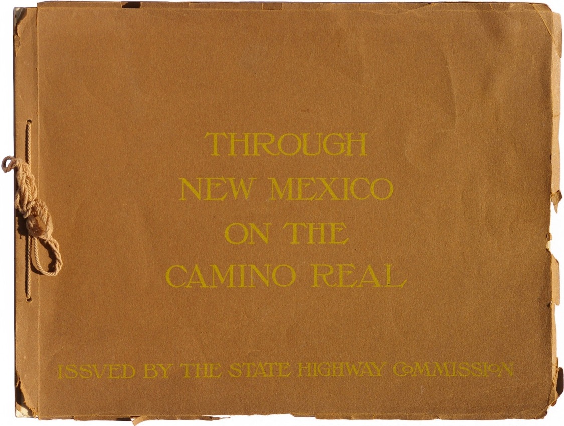
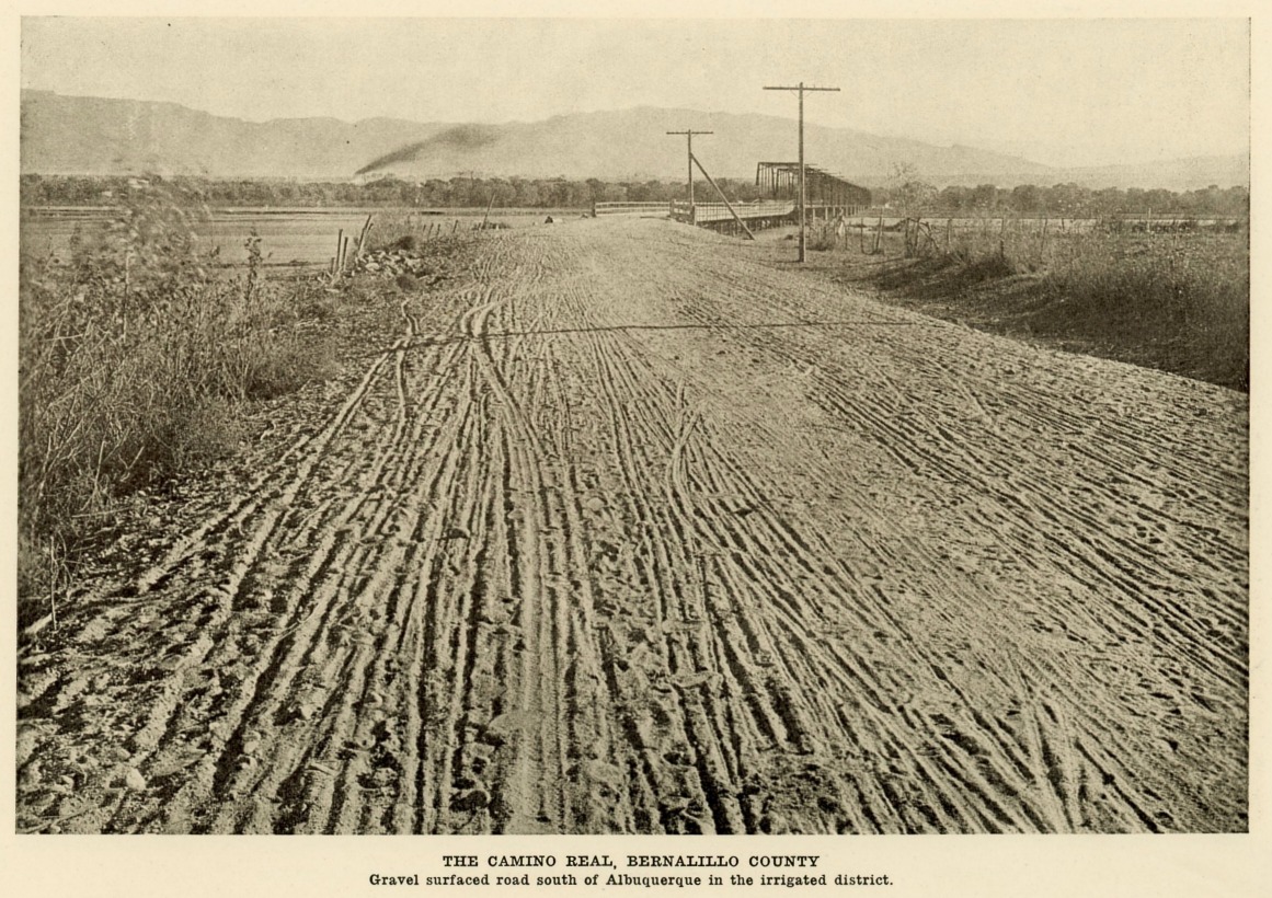
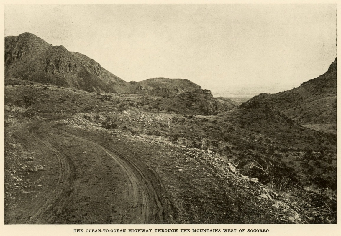
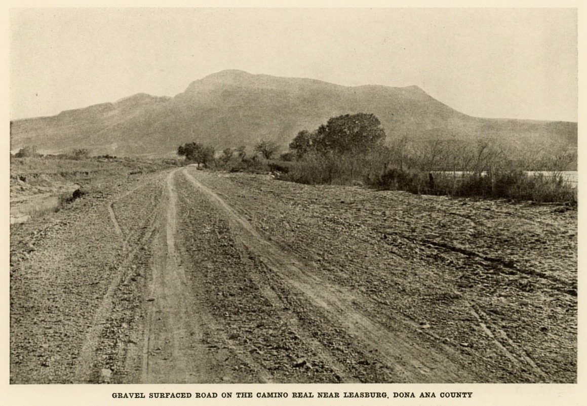
Through New Mexico on the Camino Real,
1915. During its Territorial days, and for a number years
after statehood was achieved in 1912, New Mexico had few roads and many
of those were suitable only for travel on horseback, stagecoach, or by
horse-drawn wagon. Even the State Engineer, who was the head of the
Highway Department, reported to the Governor in 1914 that the roads were
“deplorable.”
The Territorial Legislature in 1905 had authorized the construction of a
road following the path of the Camino Real, the trail from El Paso,
Texas to Santa Fe that was blazed by the Spaniards in the late 1500s.
Unfortunately, only $10,000 was allocated, a tiny fraction of the actual
amount required, and little was accomplished. Only upon creation of a
State Highway Commission in 1912 did meaningful work begin.
By June 1915 the Camino Real road had not only been constructed, but had
been extended all the way through Raton and to the Colorado state line.
That is not to say that it resembled anything like what we would
consider to be a proper road today. The majority of it was dirt, only a
little of it graveled, and just tiny bits of it here and there oiled or
paved.
Nonetheless, it was such an improvement over prior conditions that the
State Highway Commission was rightly proud of the road and issued the
book seen above, Through New Mexico on the Camino Real.
Measuring 6" x 9", it has 56 pages, 49 full-page photographs, eight
strip maps which together encompass the entire road from El Paso to
Raton, and one of the earliest known Official New Mexico State Highway
Department road maps for the entire state. It is unknown how many copies
of this book were printed, but today it is considered rare.
Reproduced here are the cover and three of the 49 photographs.
This highway was initially designated State Road 1, and later, with a
number of improvements and realignments, became U.S. Highway 85, a
two-lane paved road throughout its length. Finally, over a period
of years beginning in the 1960s, it was rebuilt on an almost entirely
new alignment as U.S. Interstate Highway 25. In conformance with the
Interstate standard it had become a four-lane divided, limited access
highway. (Portions of the old State Road 1 and U.S. 85 can still be seen
paralleling I-25, in some places nearby and in others as much as several
miles away.) |
| |
| |
|
|
 |
 |
 |
 |
|
1929-1931 |
1934 |
Amarillo Sunday News Globe,
June 10, 1934 |
San Antonio
Express,
June 17, 1934 |
|
|
|
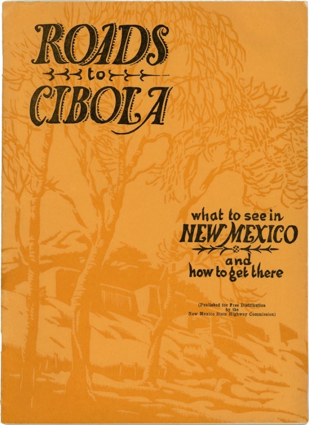
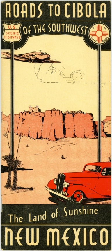
Roads to Cibola, 1929-1934.
This publication was first issued in 1929 in a magazine format of 8" x
11" and with 32 pages and 47 photographs. The selection, arrangement and
number of photographs was revised somewhat in 1930 and again in 1931. A
unique feature of the 1929-1930 editions is that they had a copy of the
Official N.M. State Highway Department road map, folded to match the
publication’s page size, and fastened to the inside back cover. The year
of the map corresponded to the year of each revision of the publication,
and the maps were identical to the individually issued Official maps
except that they were printed only on the map side, with nothing on the
back.
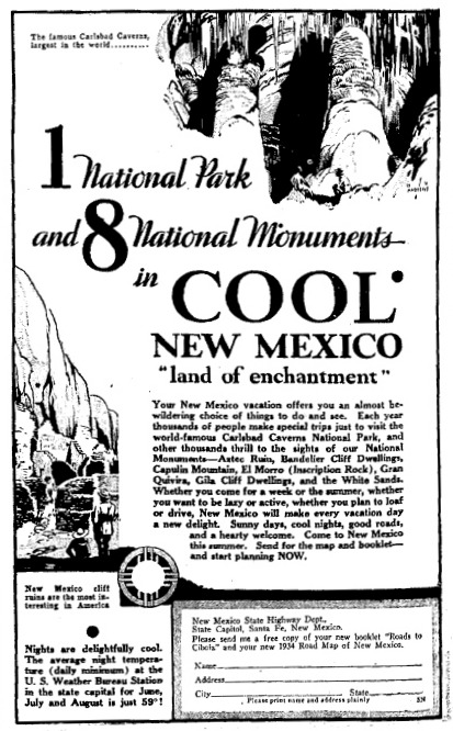
In 1934 the Highway Department set in motion an energetic advertising
campaign designed to increase the number of tourists visiting the state.
Ads were run in fourteen newspapers of nine major cities outside of New
Mexico beginning May 20 and running for ten consecutive weeks. Each ad
had a coupon that could be clipped and mailed to the Department for a
free copy of both the 1934 edition of Roads to Cibola and the
1934 Official N.M. State Highway Department road map. (A more complete
description of the advertising campaign can be found in New Mexico
Magazine for June 1934, p.12).
In preparation for the advertising blitz, Roads to Cibola was
completely revamped. The most obvious revision was a change from the
magazine format to a 4" x 9" booklet, along with elimination of the
Official road map in the back. On the other hand the number of pages was
increased to 70, and the number of photographs and other illustrations
increased to more than 250. As in the case of the earlier editions, the
publication was organized according to the attractions to be seen along
each of a number of different highways within the state. Since the full
size Official map had been eliminated, the new 1934 edition included
individual strip maps for each of the 23 highways covered.
The Highway Department reported that, in all, 170,000 copies of the
1929-1931 magazine format version were printed, plus 55,000 in the first
printing of the 1934 booklet, for a total of 225,000. (In view of
the aforementioned advertising campaign, there were almost certainly
additional printings in 1934 for which figures are not available.)
Consequently, it is not terribly difficult to locate a copy of Roads
to Cibola today. |
|
| |
 |
| |
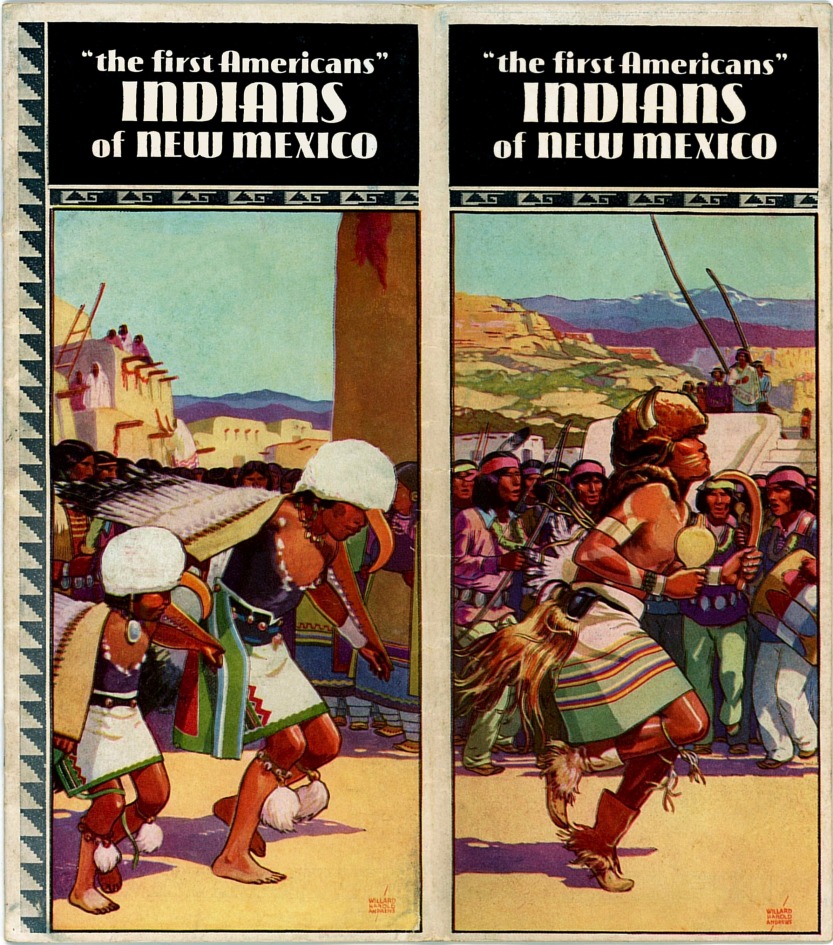
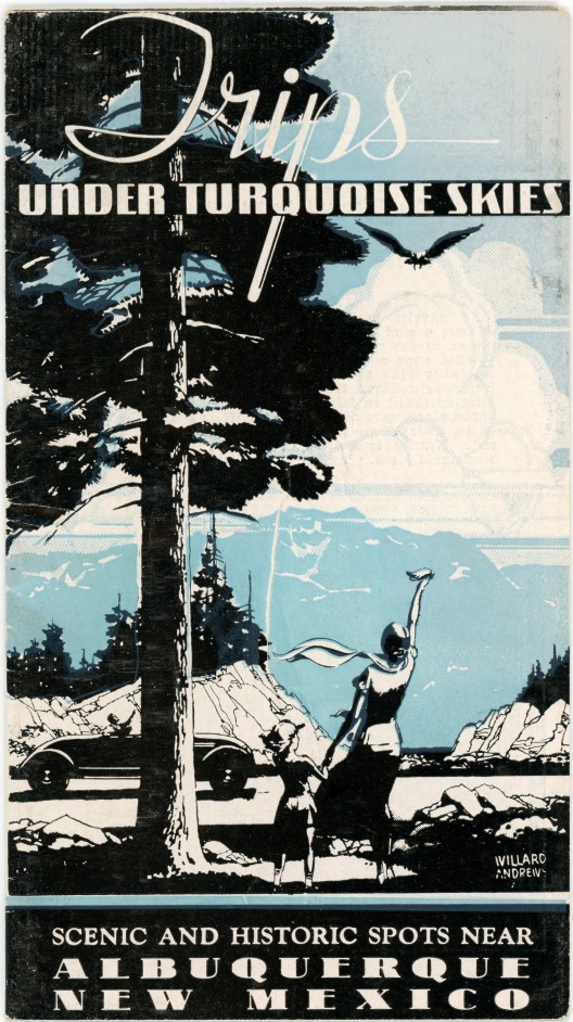
| Indians of New Mexico,
1935-1938 is generally dated by the fact that the title page contains an
introduction by Governor Clyde Tingley, who was in office 1935-1938. A
small centerfold map, drawn and illustrated by Willard Andrews, is dated
“ ’35,” which probably fixes the date to the beginning of Tingley’s
term. This is a 20-page, 8" x 9" booklet, folded lengthwise for ease of
mailing. It contains 44 black & white photographs and nine drawings
(sketches), the latter all individually signed by Andrews, as are the
two cover paintings. An interesting feature within the booklet is a
photograph of an Indian wearing an elaborate “war bonnet.” This photo is
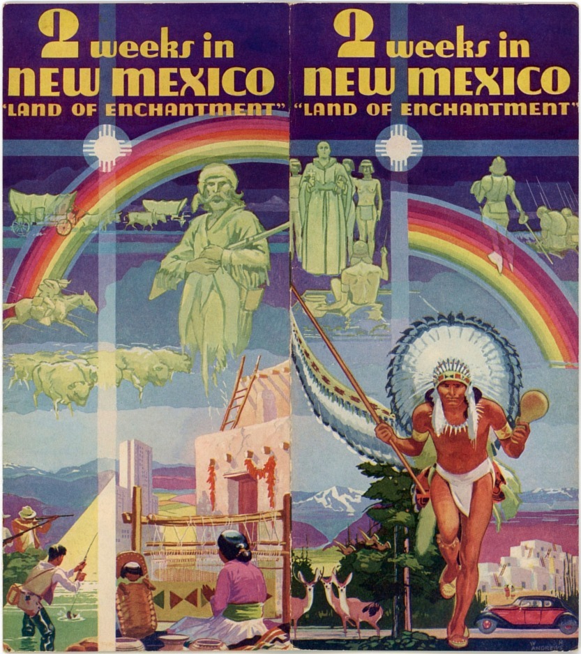
without question the inspiration for Andrews’ painting of the Indian
warrior who appears on the cover of the 1939 edition of 2 Weeks in
New Mexico, illustrated immediately below. The likeness is so well
done that one could be forgiven for thinking that the latter is a color
photograph from which the black & white image was printed. The
publication is mostly a discussion of the culture and customs of the
various tribes and pueblos in New Mexico, with brief coverage of Native
American arts. Readers today might find the publication’s narrative
patronizing, even politically incorrect. But it is what it is, a
reflection of an earlier time, now more than eight decades past. |
| |
| |
 |
| |
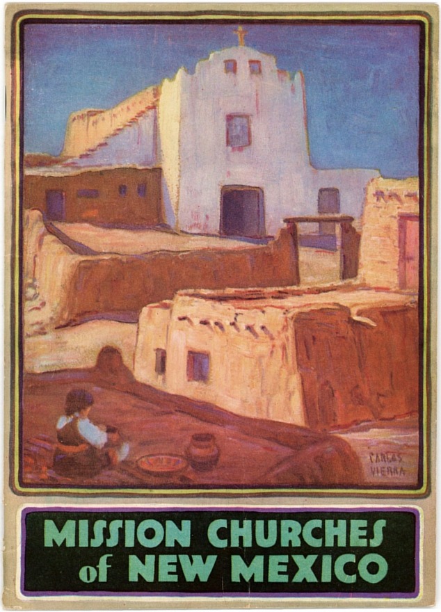
Mission Churches of New
Mexico, 1935-1938. This unusual little booklet of 40 pages
(plus covers) measures only 5¼" x 7¼". It is undated, but contains a
full page greeting by Governor Clyde Tingley who served 1935-1938. No
fewer than 23 different mission churches, some in ruins, are described
in considerable detail. In addition to 26 black & white photos there are
36 painted illustrations. The front cover is by Carlos Vierra and the
back cover by Willard H. Andrews. Only a few of the interior paintings
are signed, all of those by Willard Andrews, with the remainder
appearing to be his work as well.
|
| |
| |
|
|
 |
|
 |
|
| |
1934, 1938 |
|
1939 |
|
|
| |
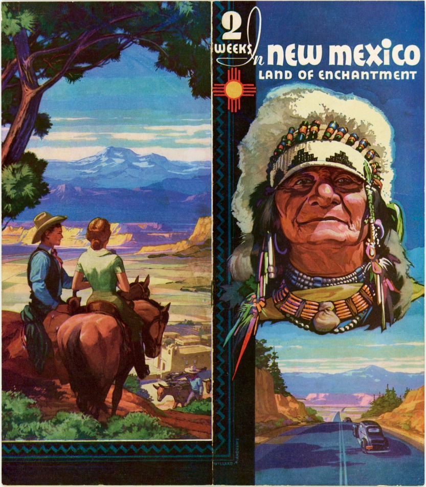
| 1934-1939 booklet, 2 Weeks
in New Mexico. At 4" x 9", this publication is similar in size
to the 1934 Roads to Cibola shown above, but with fewer pages and photos
(32 and 66, respectively). The material presented is also similar but
the photos and narrative used are different from that in Roads to
Cibola. Editions of 2 Weeks in New Mexico are known to
exist for 1934, 1938 and 1939, and while the photographs are essentially
the same in all editions, the supplemental graphics in the 1934 edition
are different from those in the later ones. The title page in the 1934
edition states that the booklet has been compiled and printed by the New
Mexico State Highway Department, while the 1938 edition identifies the
source as the New Mexico State Tourist Bureau, reflecting the creation
of the Bureau in 1935 as a division within the Highway Department.
Other than the cover (and a greeting inside by a different governor) the
1939 edition is identical to that of 1938. The cover paintings for all
editions were done by New Mexico artist Willard H. Andrews, whose work
appears inside the booklets, as well as on other N.M. Tourist Bureau
publications. |
| |
| |
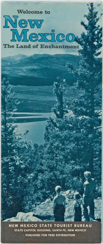
%20-%20Welcome%20to%20the%20Land%20of%20Enchantment%20-%20bj-bj.jpg) |
| |
| Welcome to the Land of Enchantment,
circa 1938. This is a small folder, 3½" x 6¾", which opens out to
approximately 14" x 14". Has 31 mostly small photos, with a brief
description of each scene. The folder is not dated, but based on the
body style of the automobile, the fact that it is a publication of the
Tourist Bureau which was created in 1935, and the fact that the
graphics accompanying the photos are similar to those in the 1938
edition of the 2 Weeks in New Mexico booklet shown above, its
date is estimated to be circa 1938. |
| |
| |
 |
| |
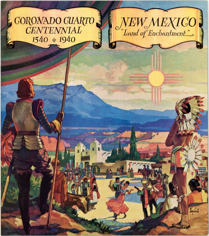
Coronado Cuarto Centennial
1540-1940 is a 28-page booklet measuring 8" x 9". Though mostly
general in nature, several pages, including the cover, are devoted to
commemoration of the 400th anniversary of the passage through New Mexico
by the Spaniard Francisco Vásquez de Coronado in the year 1540. Contains
a greeting by Governor John E. Miles and 62 black & white photos along
with a 9" x 16" centerfold map showing only the primary highways.
Principal attractions depicted on the map are Indian reservations and
pueblos, state monuments, national forests, national parks and national
monuments. The map and the cover painting are by New Mexico artist
Willard H. Andrews. (The Coronado Cuarto Centennial was also
commemorated by a slogan on New Mexico’s 1940 license plates.)
|
| |
| |
 |
| Partial panel of map side of
1941 Recreational Map of New Mexico |
| |
 |
 |
 |
1941
Recreational Map of New Mexico |
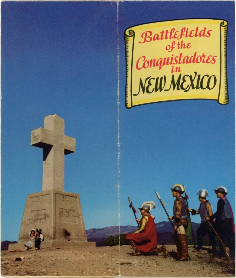
1942
Battlefields of the Conquistadors in New Mexico |
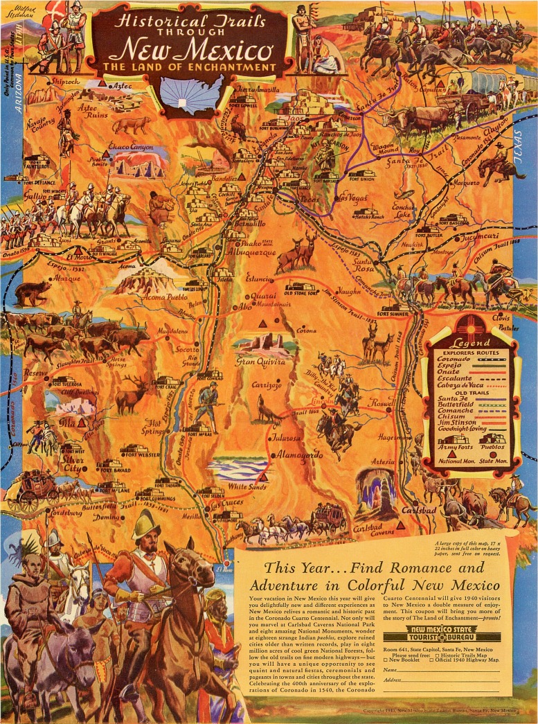
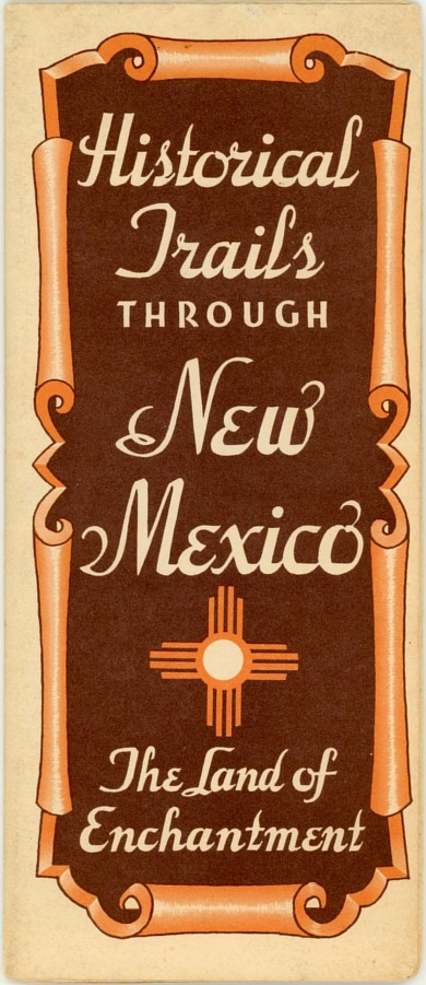
1951-1956
Historical Trails Through New Mexico |
|
|
|
|
|
|
| |
 |
|
 |
|
| |
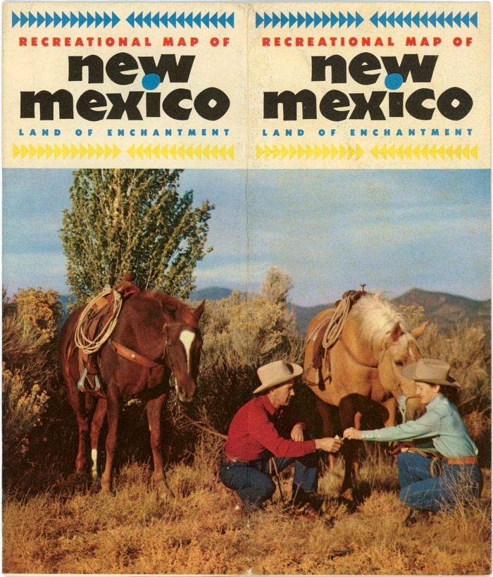
1952
Recreational Map of New Mexico |
|
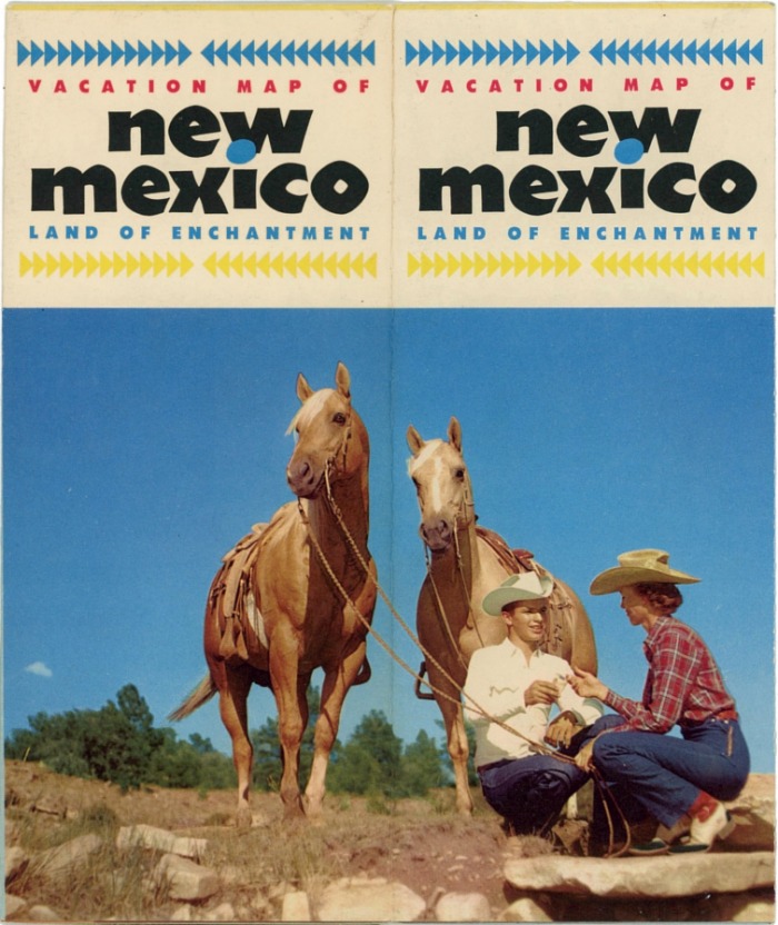
1950s
Vacation Map of New Mexico |
|
| |
|
|
|
|
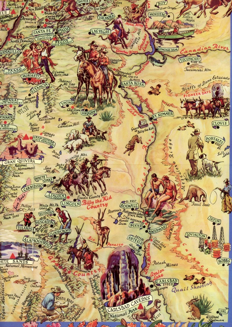
Illustrated Maps, 1941-1956.
Sometimes also called cartoon maps, their principal purpose is to show
in a general way where various attractions are to be found, and for the
most part are not particularly useful for navigation. Although the
subject matter varies from one map to the next, they all have the
general appearance of the partial panel of the 1941 “Recreational Map of
New Mexico” shown above. New Mexico issued a number of these types of
maps with varying themes during the 1940s and ’50s, several examples of
which are illustrated here.
The 1941 “Recreational Map of New Mexico” was reissued in 1952 under the
same name but with a different cover (see above). “Battlefields of the
Conquistadors in New Mexico” (1942) is reported to have also been
reissued in subsequent years. “Historical Trails through New Mexico” is
known to have been published in both 1951 and 1956, the former
containing a greeting from Governor Edwin L. Mechem, and the latter a
greeting from Governor John F. Simms. There may have also been other
releases of all of these maps. Most of the cartoon maps were illustrated
by artist Wilfred Stedman of Tesuque, N.M., and all of them conform to
dimensions of about 3¾" x 8½" when folded, and 17" x 22" when fully
open.
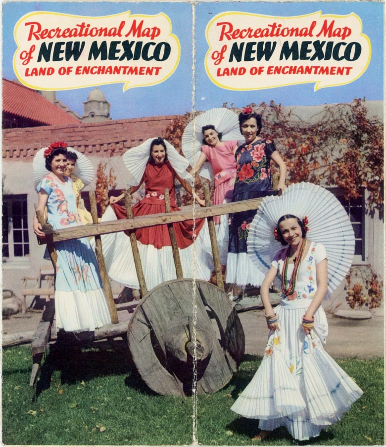
The “1952 Recreational Map of New Mexico” and its undated companion,
“Vacation Map of New Mexico,” though they have essentially identical
themes on the cover, differ inside in that they have maps and text that
are directed toward different audiences. The former emphasizes
recreational activities, while the latter, with its coverage of scenic
and cultural sites, has the out-of-state tourist in mind. Smokey Bear,
who was born in New Mexico's Lincoln National Forest in 1950, likely
would not have been pleased with either of these two cover
illustrations, both of which depict couples sharing cigarettes,
apparently to be smoked as they crouch in dry grass. |
| |
| |
| |
 |
 |
| Insert included with larger version |
Original mailing envelope for larger
version |
|
| |
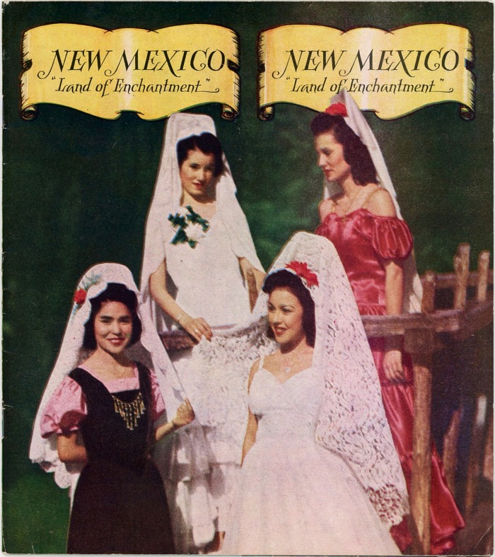
| New Mexico The Land of Enchantment
appeared in several undated versions during the administration of
Governor Thomas J. Mabry (1947-1950). Because of the absence of
publication dates it is not known which appeared first, but one is in a
larger 8" x 10½" booklet format with 32 pages and 84 photographs, and
others in a somewhat smaller 8" x 9" booklet size with 32 pages and 79
photos. Despite the size difference the content is quite similar, with
photos showing much the same subject matter. The larger publication was
also accompanied by a 4-page insert with additional details on the
state, its climate and its attractions. The two smaller versions
illustrated here are essentially identical to each other except for the
cover photograph and the calendar of events on the back. And all of
them, both large and small, are derived from the Coronado Cuarto
Centennial 1540-1940 booklet (see above), whose 63 photos
almost all reappear in the 1947-1950 publications. |
|
| |
 |
| |
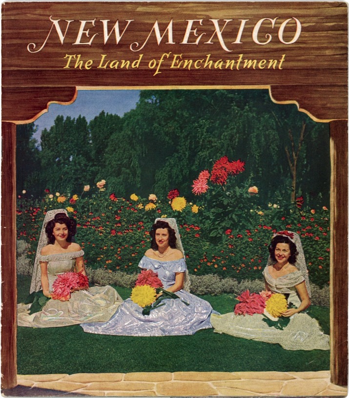
| New Mexico The Land of Enchantment.
Another undated publication, this one appears to be from the
early 1950s or possibly the late 1940s. In 6" x 9" booklet format, it
has 32 pages and some 53 color and black & white photographs, some of
which will be recognized from other New Mexico tourism publications,
both earlier and later. |
| |
| |
 |
| |
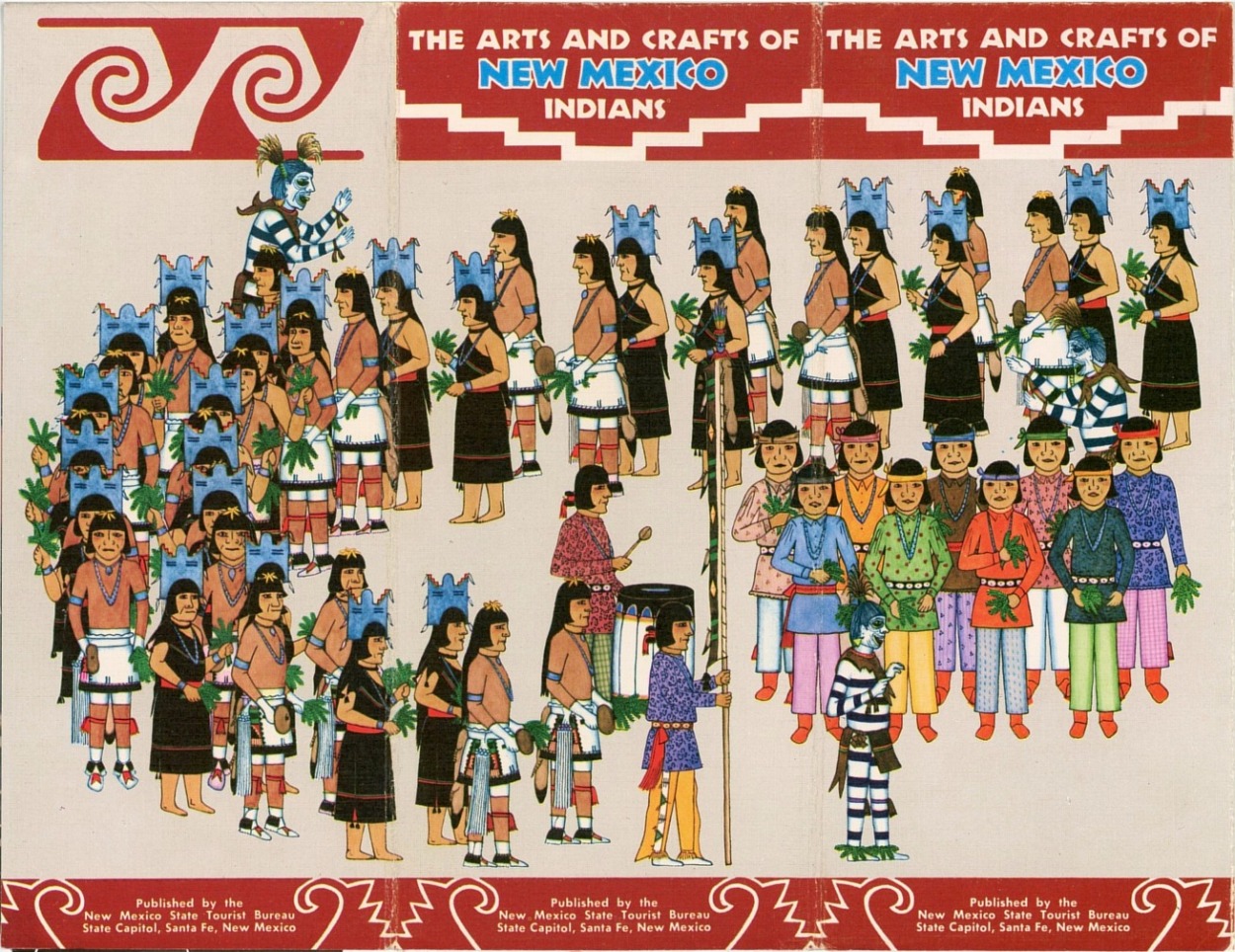
| The Arts and Crafts of New Mexico
Indians is a 3-2/3" x 8-1/2" folder which opens out to 17" x
22", ca. mid-1950s. Has 6 paintings and 5 photographs, all in color. Not
so much a travel publication as an introduction to the art works of the
Native Americans of New Mexico, including jewelry, pottery and woven
blankets, along with a brief discussion of the culture and customs of
the various tribes and pueblos. Only one of the six paintings in the
folder is signed, and that by Gilbert Atencio, dated “54.”
However, the striking similarities in their appearance makes it
reasonable to infer that all of them were done by him. The five color
photographs highlight the aforementioned arts. The folder itself is not
dated, but Atencio’s date of “54” corroborates that it is a mid-1950s
publication. |
|
| |
 |
| |
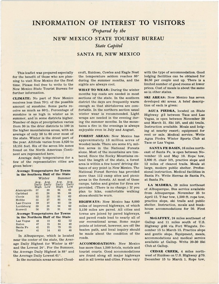
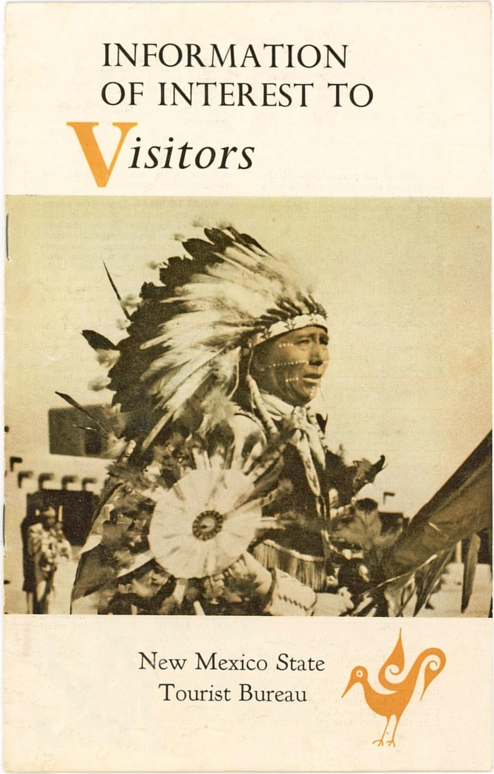
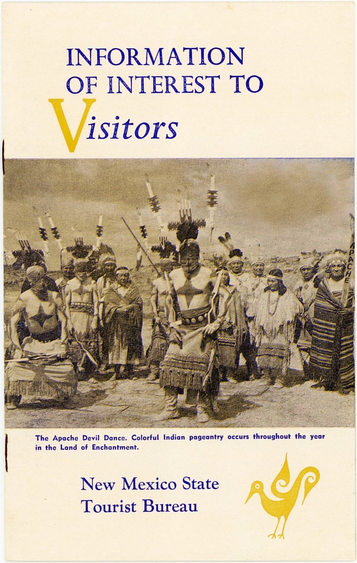
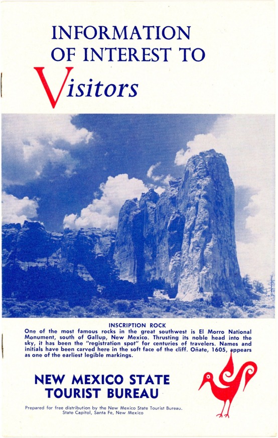
| Information of Interest to Visitors,
1953, 1955 and 1957. Small booklets, approximately 5¼" x 8¼", five b&w photos,
12 pages. Have descriptions of numerous scenic and cultural locations, as
well as activities for the tourist. An extensive Calendar of Events for
1953, 1955 and 1957, respectively, is included. |
| |
| |
 |
| |
| Adobe Wonderland. An 8-page
booklet measuring about 9" X 12", circa 1954, the last year Governor
Mechem was in office. The content is similar to that in the two booklets
immediately above. |
| |
| |
| |
 |
| |
| Welcome to New Mexico The Land of
Enchantment. Undated folders, circa mid-1950s, 3½" x 8¼",
open to 20½" x 16½". These have detailed descriptions of various aspects
of the state along with roughly 18 black & white photographs and four
small maps showing points of interest. Both of the folders shown are
undated and have substantially identical content with the following
exceptions: The folder at left contains a greeting from Governor John F.
Simms (in office 1955-1956), which positively dates the publication to
that time period. This brochure also has a section devoted exclusively
to the town of Deming, N.M. The folder at right appears to be the later
of the two, but lacks any gubernatorial greeting. Moreover, the Deming
section has been replaced by a history of New Mexico. |
| |
| |
.jpg) |
| |
| Put All Your Vacation Dreams Together in
Romantic New Mexico. An all-color brochure measuring 3¾"
x 8½", opening out to 22" x 17". Dated February 1958, the folder has
several small maps which lack any serious detail, but does have 45 color
photos. |
|
| |
 |
| |
| New Mexico Land of Enchantment folder.
Measures 8½" x 11" but was folded in thirds for mailing. Opens out to
eight contiguous pages (front and back) on a long 11" x 34" sheet with a
total of 17 black & white photos. While much of the publication is
devoted to tourism and scenic attractions, a fair amount is obviously
targeted at people who might want to permanently relocate to New Mexico,
covering such topics as education, highways, industry, employment,
retirement and taxes. The folder is undated but is a production of the
New Mexico Department of Development (Tourist Division) which was an
agency created in the early 1960s, and the information contained therein
appears to be from that time period. |
| |
| |
 |
| |
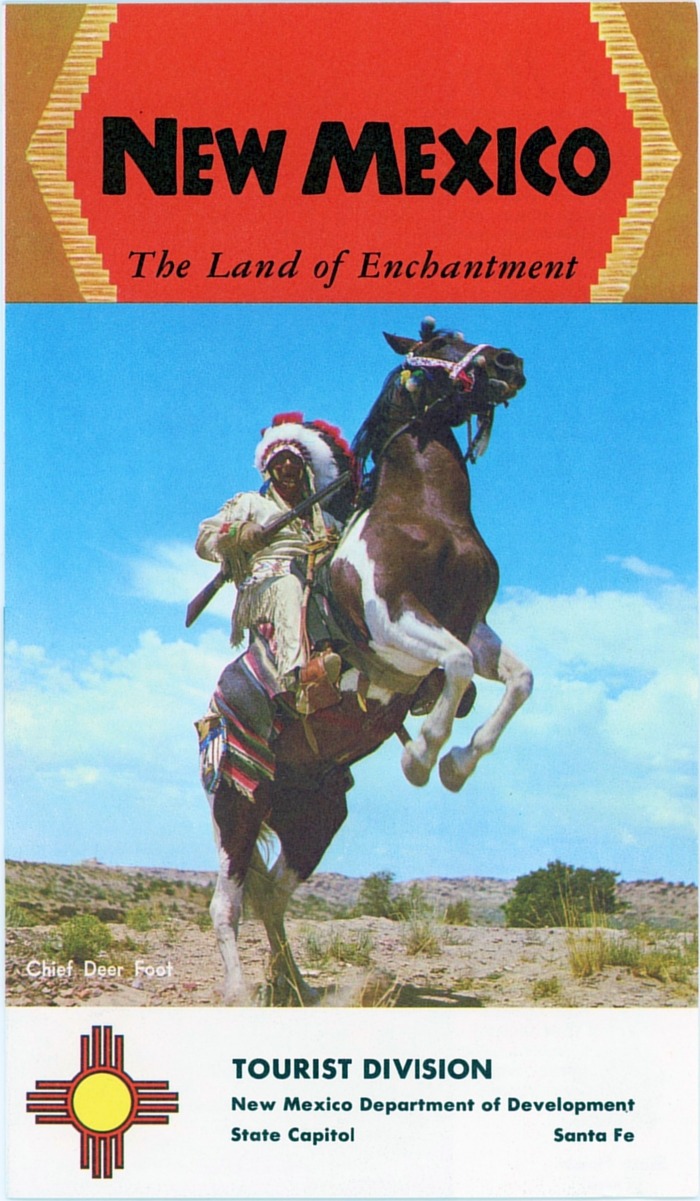
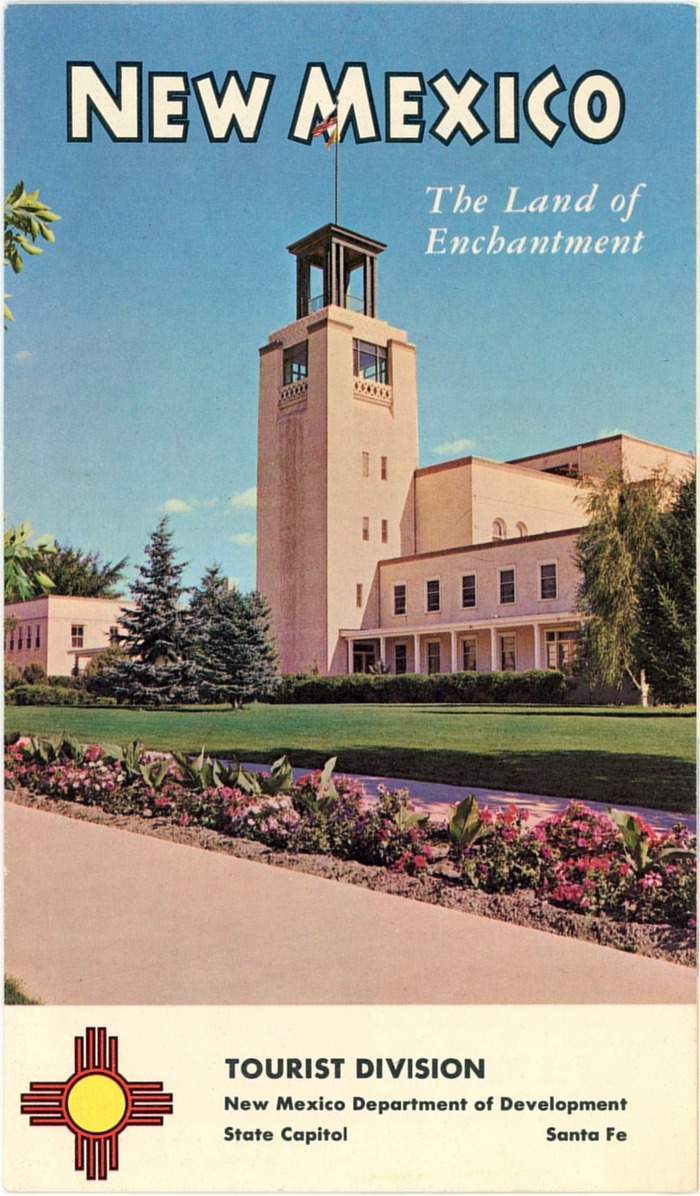
| New Mexico The Land of Enchantment
Tourist Division folders. Shown here are two undated
publications of the New Mexico Department of Development Tourist
Division, which appear to be from the 1960s. Both of these measure 4¾" x
8" and open out to 8" x 17". The first (illustrating Chief Deer Foot)
has five black & white plus seven color photos, while the second
(illustrating the old Capitol Building constructed in 1900) has five
color photographs plus several small painted illustrations. The text in
both provides a brief history of New Mexico, a description of its
geography, and a very brief summary of the Native American tribes within
the state. |
| |
|
 |
%20-%20See%20Southern%20New%20Mexico%20-%20bj-bj.jpg)
 |
|
Local and regional tourism publications.
There has always been much interest at the local level in promoting
tourism, as the dollars spent in doing so have a direct effect in
bringing tourists—and their dollars—close to home. Illustrated here are
just a very few of the innumerable publications distributed for this
purpose.
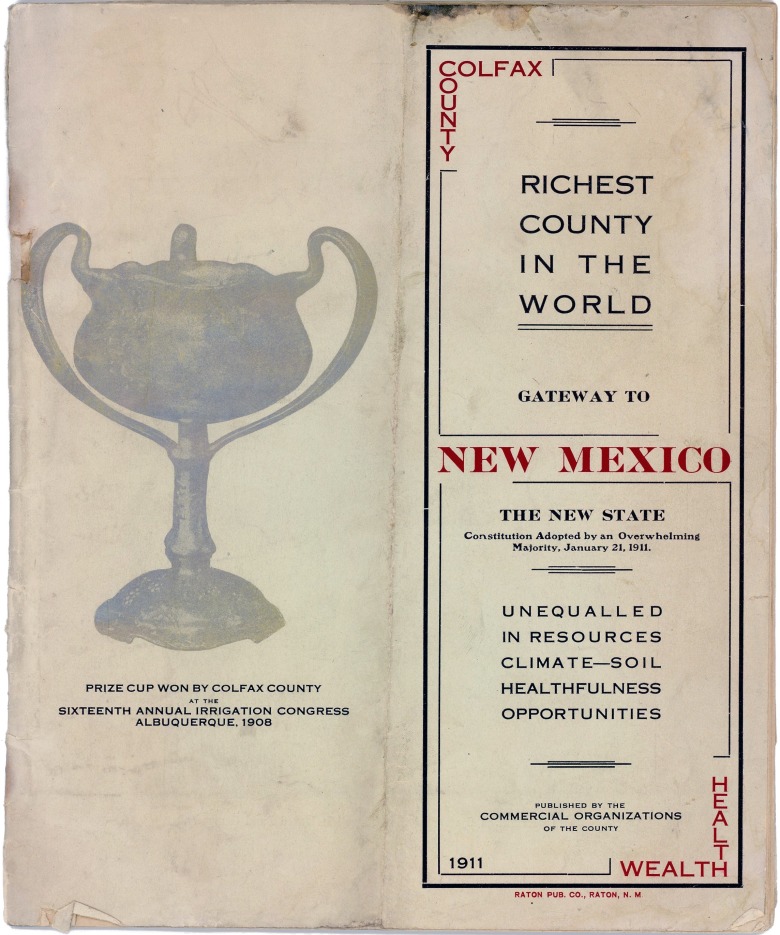
Colfax County - Richest County in the World - 1911.
Predating statehood by one year, measuring 7½" x 9", and with 36 pages
and 36 photos, this is an exceptionally detailed booklet published by a
consortium of commercial organizations in Colfax County. At this early
date there was as much interest in enticing settlers to the area as
tourists, and the publication touts not only the scenery but the
availability of rich crop land at low prices and opportunities for
people who would establish agriculture-related industries not yet in
existence in the county. Examples given which would make use of local
resources include the need for a flour mill, wool scouring plant, woolen
mill, cement factory, brick manufacturing, food canning factories, and
others.
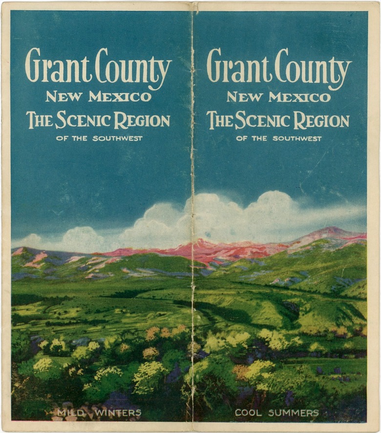
Grant County New Mexico - The Scenic Region of the Southwest -
1926. This 8" x 9" folder has 22 scenic photographs and a
fairly detailed 16" x 18" map of Grant County tucked inside of it.
Published by the Grant County Chamber of Commerce.
See Southern New Mexico - early 1930s. An 8" x 9",
4-page booklet with 32 photographs focusing on attractions in the
southern half of the state. Has a small, very basic map in the
centerfold. Mutually published by the following organizations:
Alamogordo Commercial Club, Capitan Commercial Club, Carlsbad Chamber of
Commerce, Carrizozo Commercial Club, Cloudcroft Commercial Club, Deming
Chamber of Commerce, Hatch Chamber of Commerce, Hot Springs Chamber of
Commerce, Lordsburg Chamber of Commerce, Silver City Chamber of
Commerce, Roswell Chamber of Commerce. |
| |
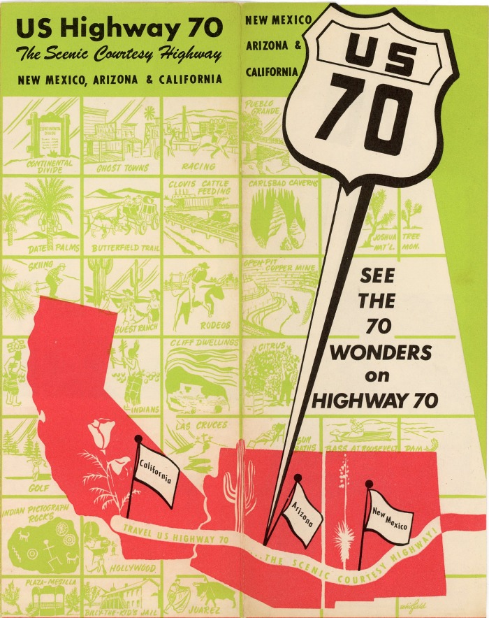
| U.S. Highway 70 the Scenic Courtesy
Highway. Early 1950s. Measures 3¾" x 9", and opens out to
14½" x 18". Has fifteen black & white photographs and two sketch maps
showing points of interest and mileages between towns. Not readily
apparent in the photograph above is the fact that the publication has a
unique die cut cover following the outline of the US 70 sign. Though
Highway 70 runs all the way from the Atlantic to the Pacific Ocean, this
folder covers only the portion which lies in New Mexico, Arizona, and
California. Undated and with no attribution as to sponsors, it was
likely published by an association of chambers of commerce in the three
covered states. The date can be roughly estimated from the mention of
White Sands Proving Ground in New Mexico and the photo of a V2 rocket
being fired at that facility. The first V2 launch there occurred in
March of 1946, and the installation’s name was changed to White Sands
Missile Range in May 1958. The midpoint of that range suggests a
publication date in the early 1950s. |
| |
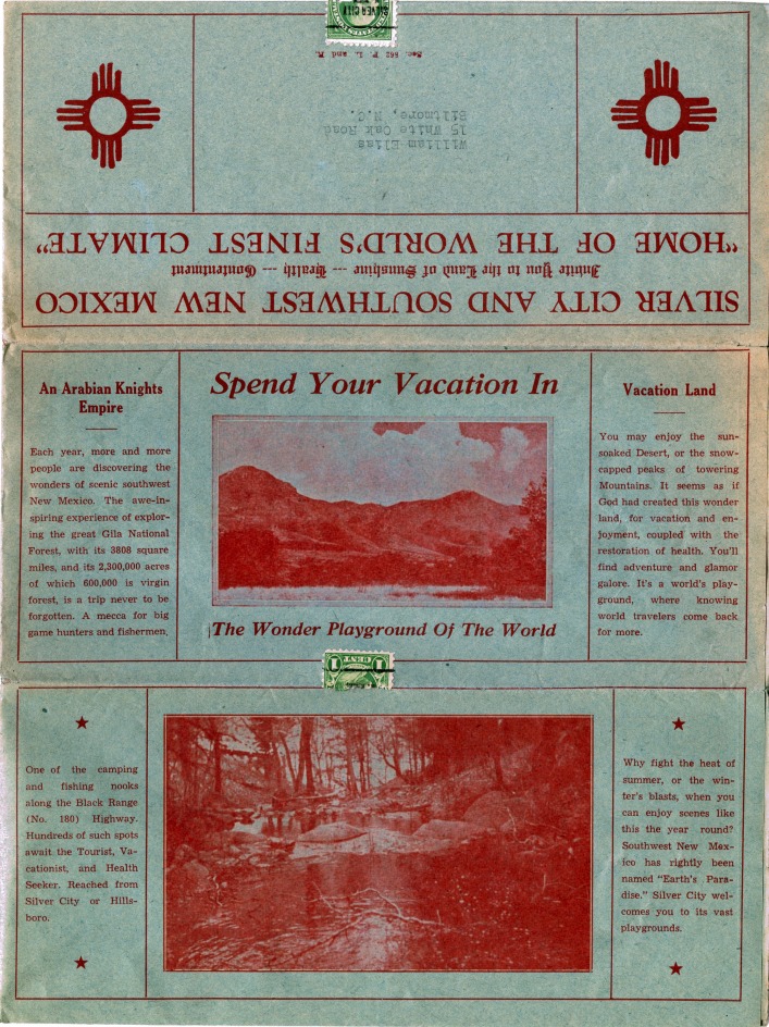
| Silver City and Southwest New Mexico,
1938. An unusual and informative folder printed in red ink on
greenish-blue paper. Folded to 4" x 9" for mailing, the publication
opens out to 18" x 24". There is much detailed text describing scenic,
agricultural, business, educational, climate and other features of the
region, all clearly catering to both tourists and potential settlers.
Included are 39 half-tone photographs which show many interesting scenes
of the period, but much of whose detail and clarity are lost by the
combination of the red ink on colored paper. Published in 1938 by the
Southwest Junior Chamber of Commerce and the Bureau of Livestock, Mines
and Agriculture. |
| |
 |
| |
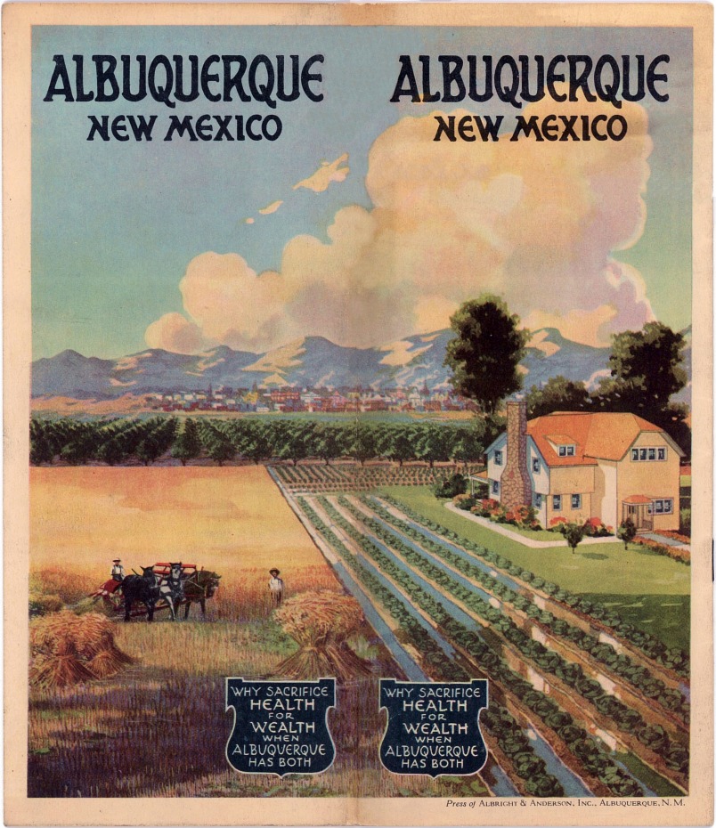
| Albuquerque - Late 1920s.
Issued by the Albuquerque Chamber of Commerce and consisting of sixteen
pages, each measuring 7½" x 8¾", this booklet is undated but gives the
population of Albuquerque as 26,000, a circumstance reached at the very
end of the 1920s. It is highly unusual in that all 73 photographs
included therein are in full color, each one expertly hand tinted. With
pictures and descriptions of agricultural lands, schools, hotels, banks,
wholesale establishments, fraternal organizations, churches, medical
facilities and recreational venues, the publication is focused entirely
on attracting settlers to Albuquerque and its environs, with no mention
at all of tourism. The cover is the clincher, a stunning painting of a
fabulous home in the midst of a productive irrigated farm and orchard
with the city just a short distance away in the background. |
| |
| |
 |
| |
Albuquerque - Late 1930s. This
small brochure, measuring 3-1/2" x 6-1/4", folds out to 14" x 12-1/2",
and with some 24 black and white photographs, was published by the
Albuquerque Chamber of Commerce. The cover art by Willard Andrews is
similar to that done by him for some of the state-sponsored publications
seen above that were issued during the 1930s and 1940s.
|
| |
| |
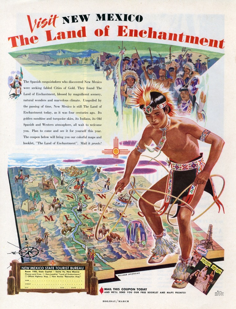
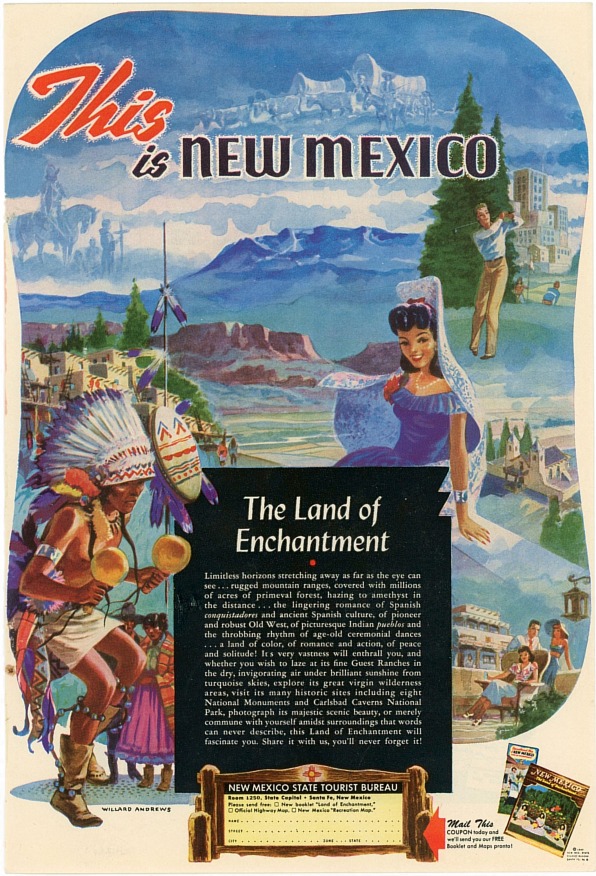
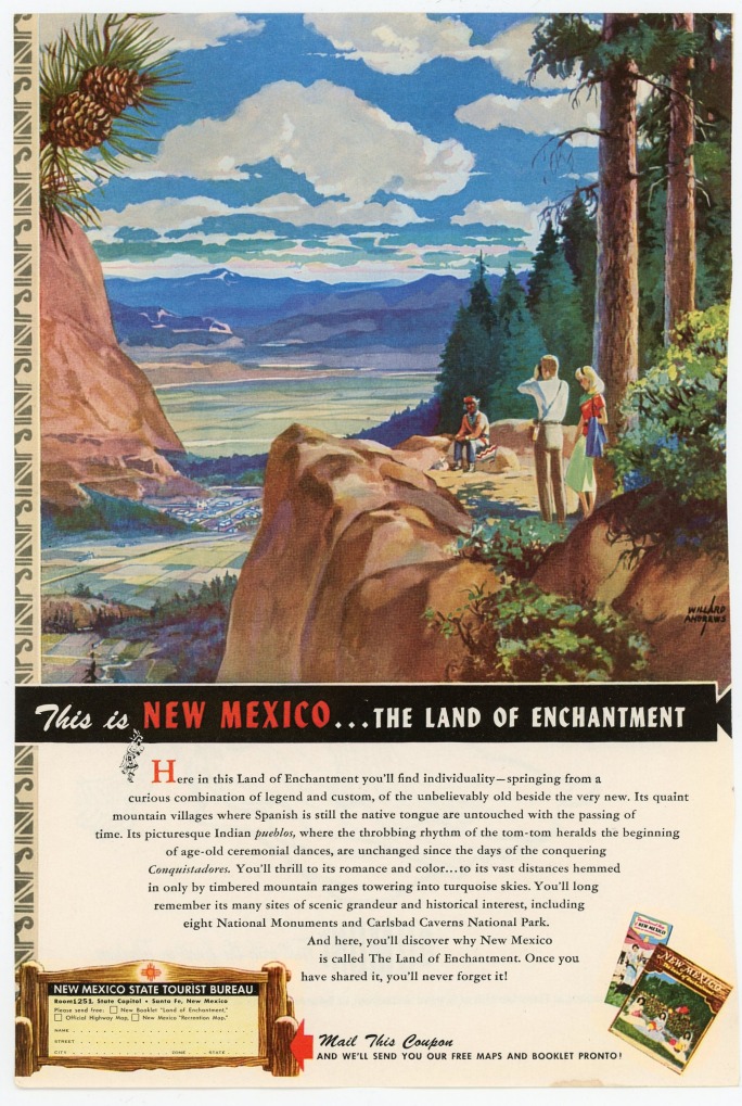
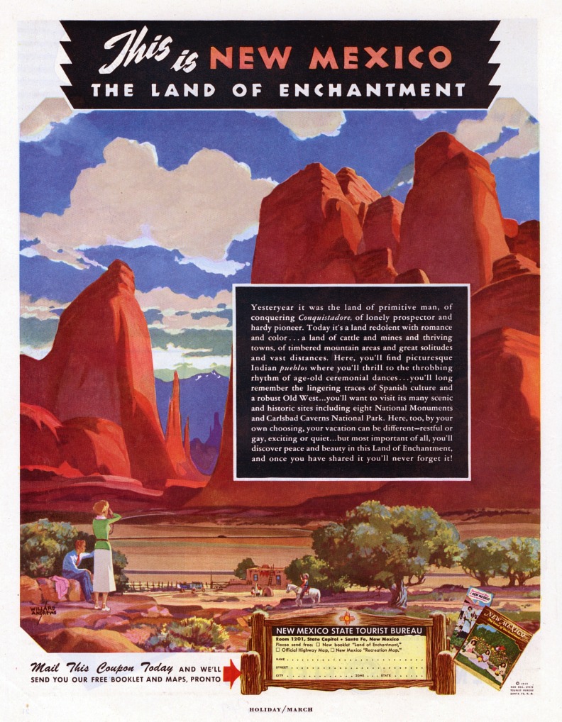
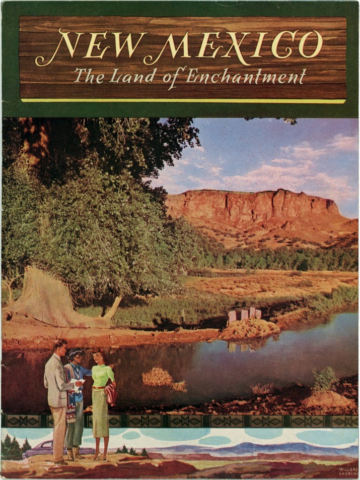
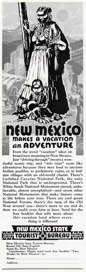
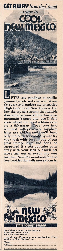
New Mexico State Tourist Bureau
Magazine Advertisements |
| |
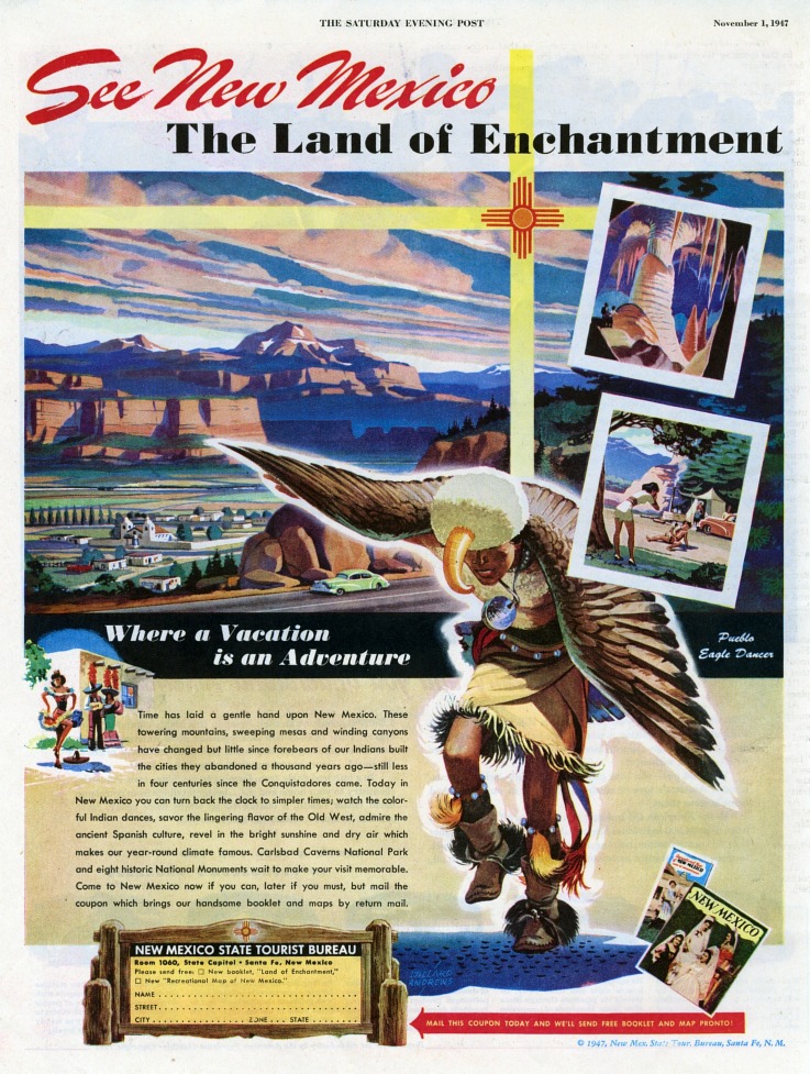
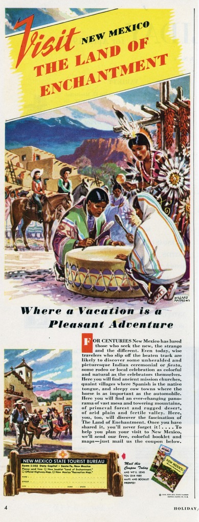
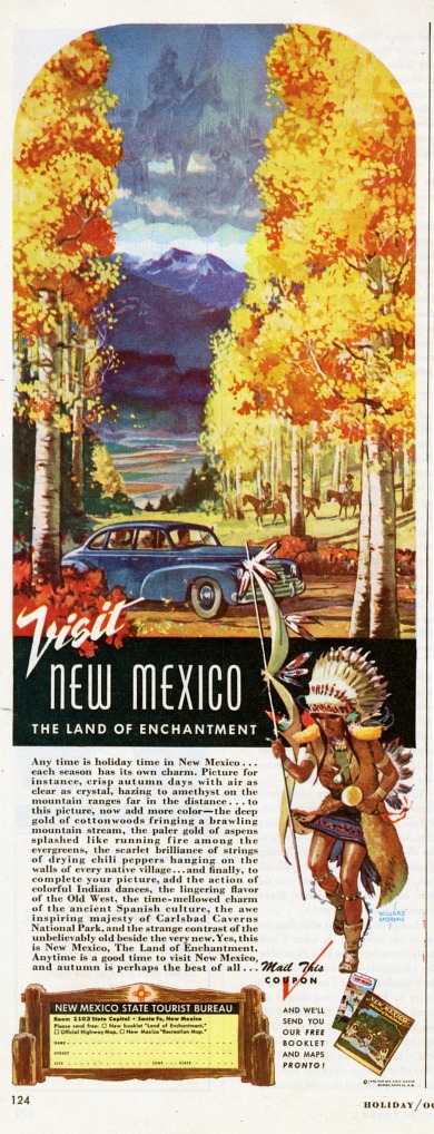
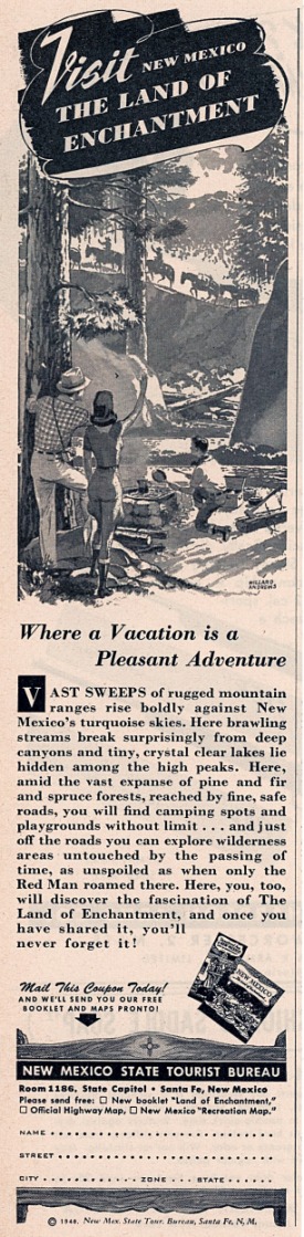
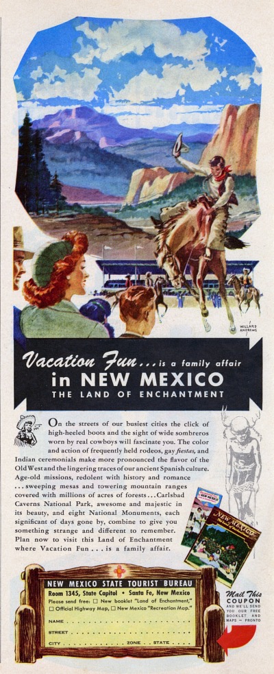
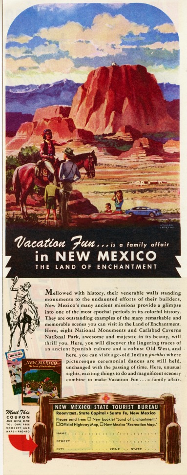
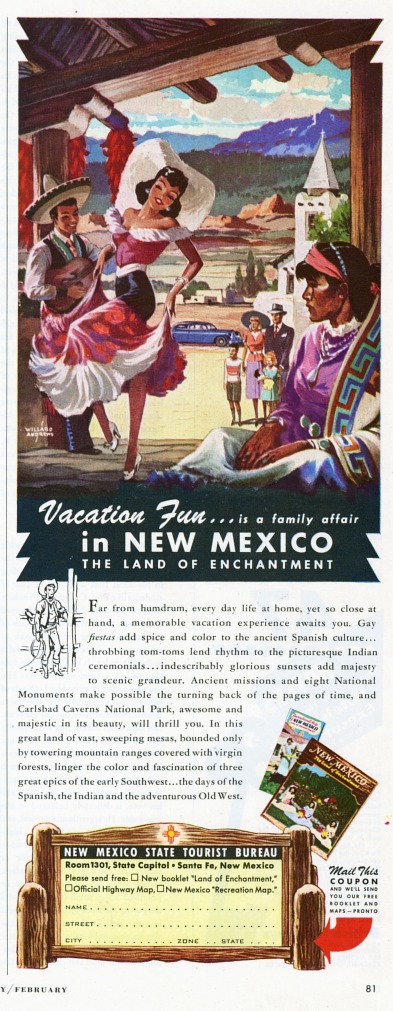
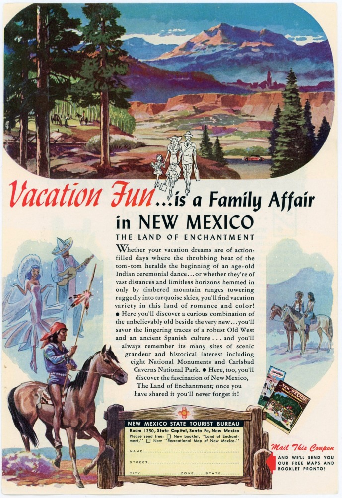
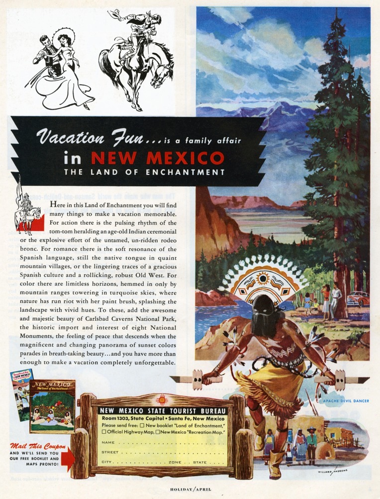
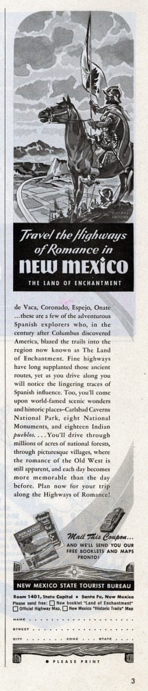
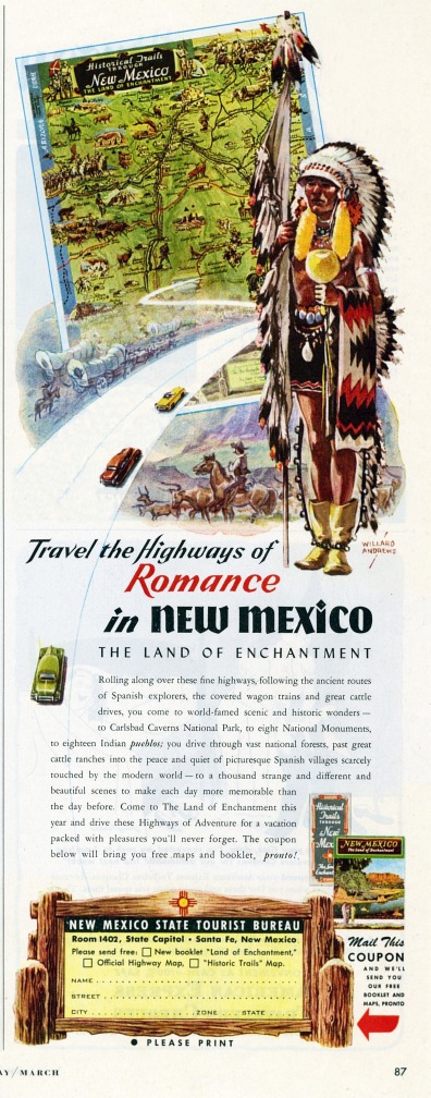
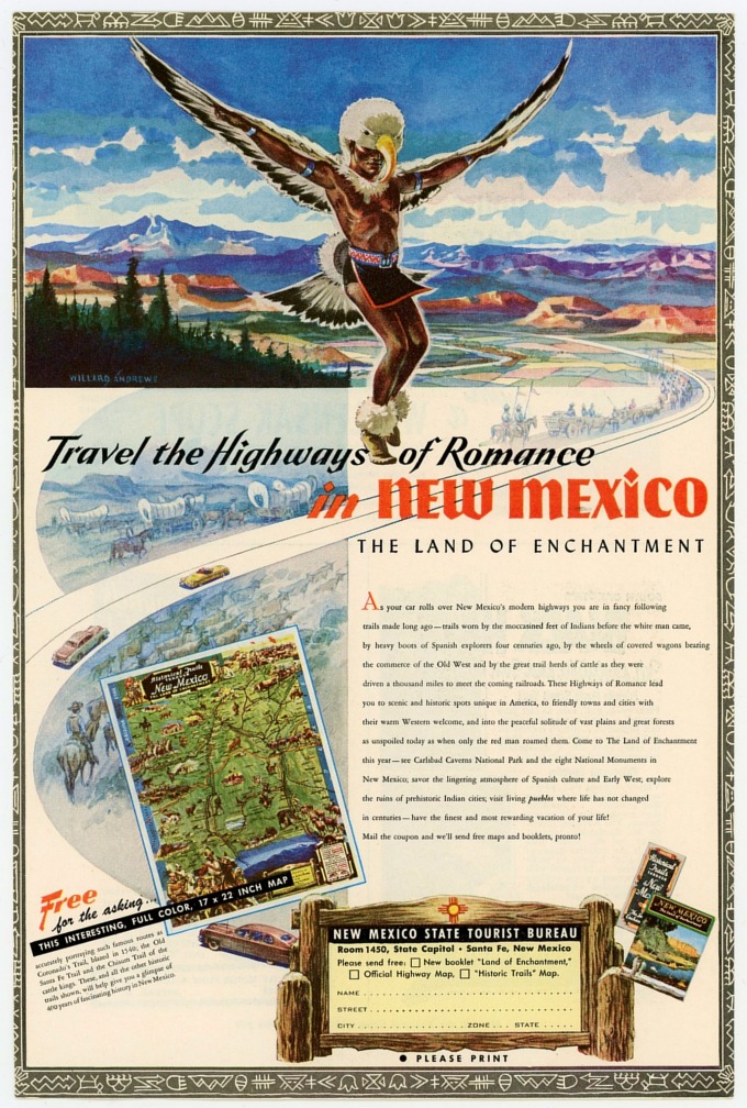
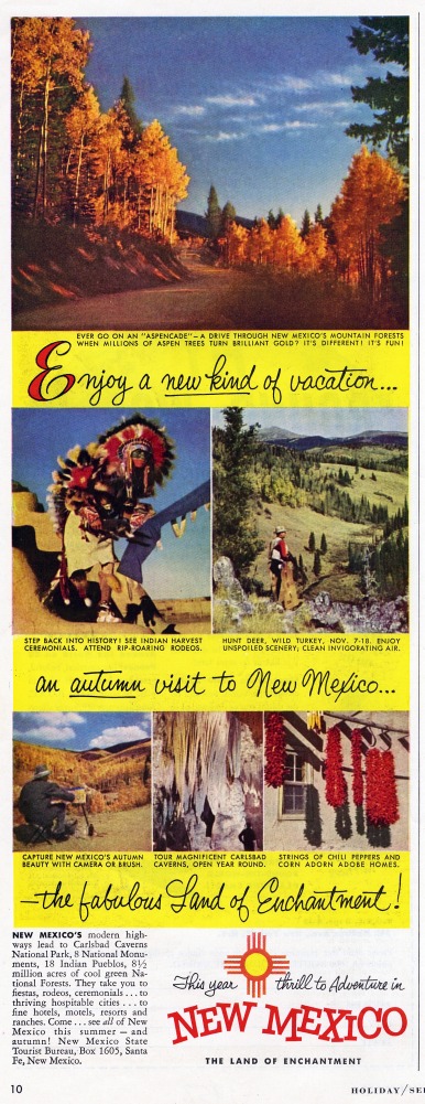
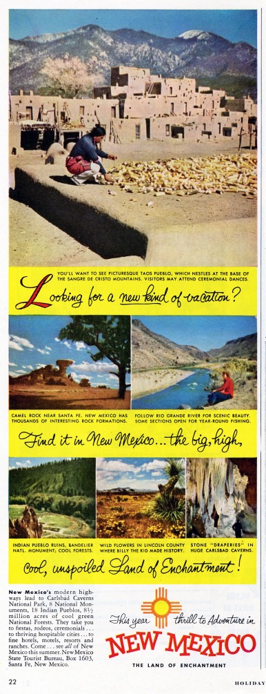
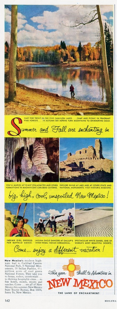
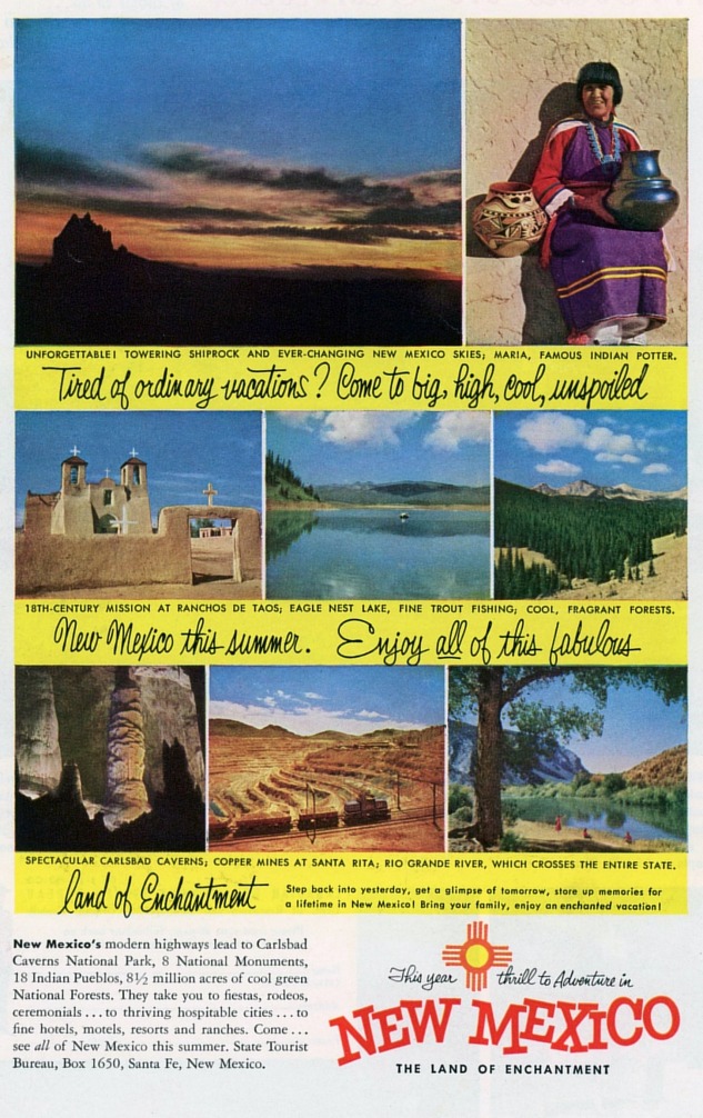
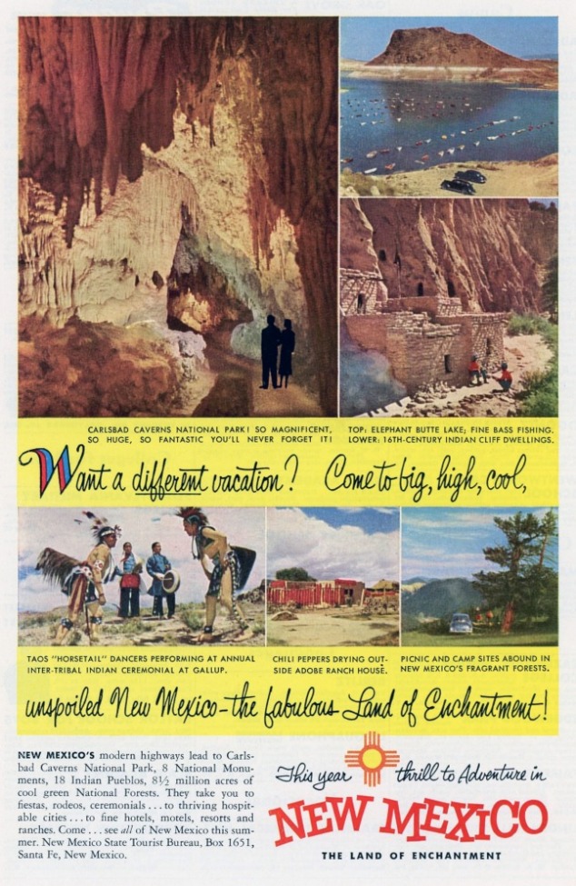
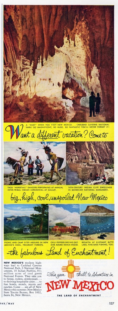
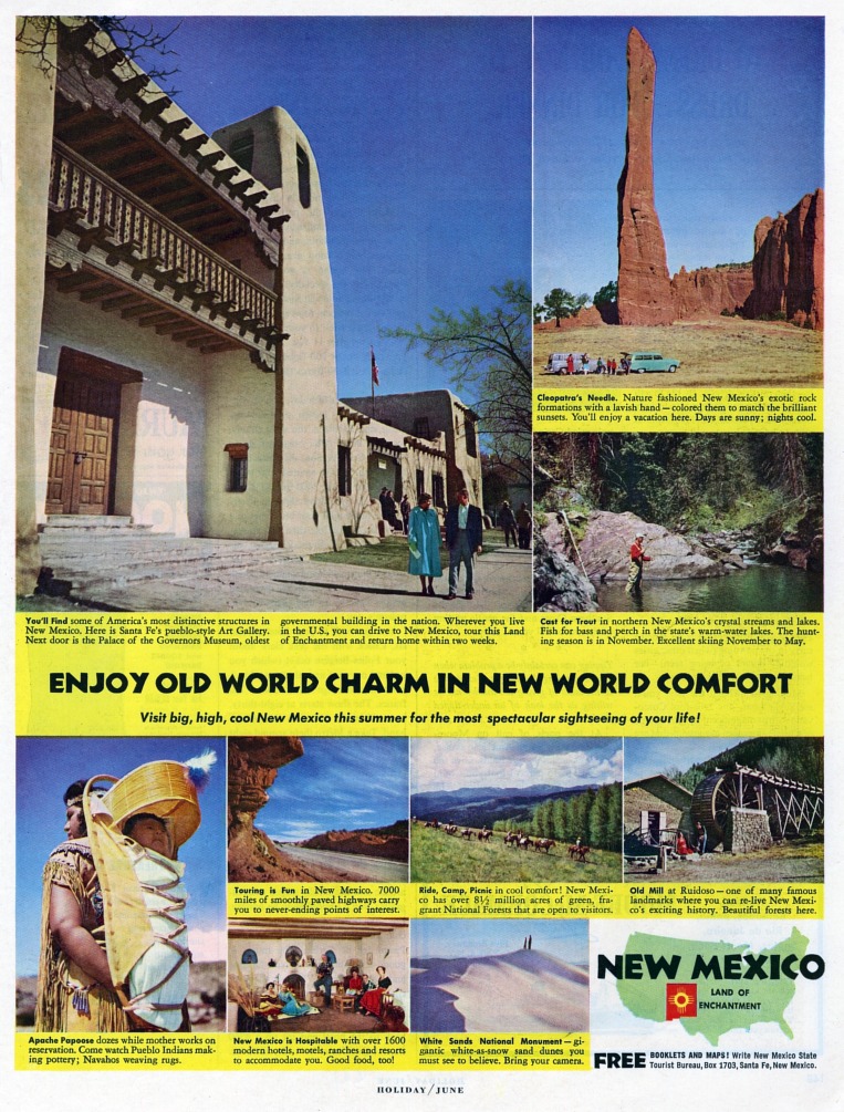
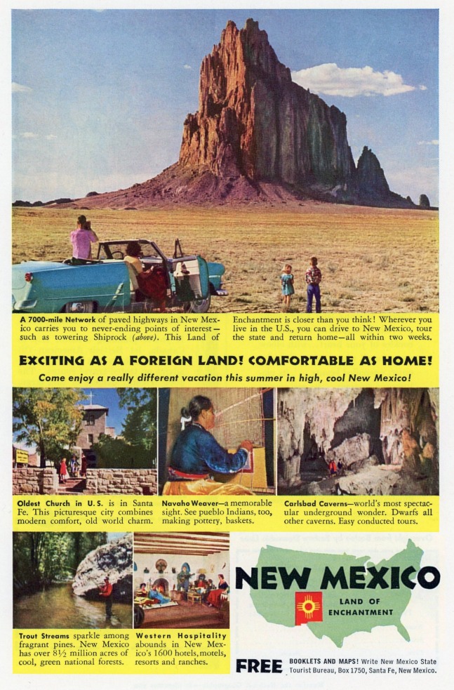
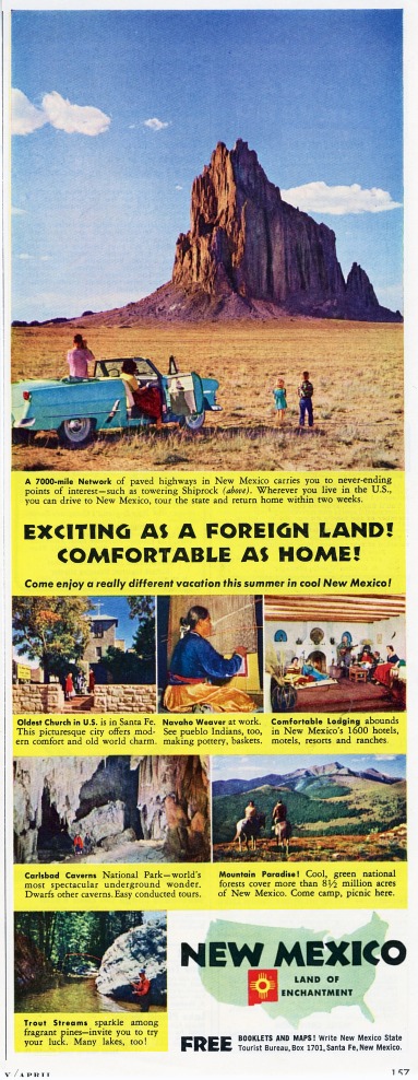
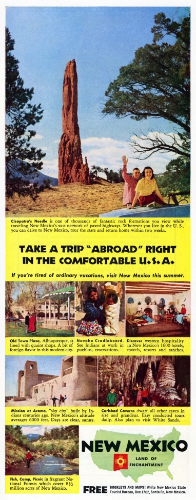
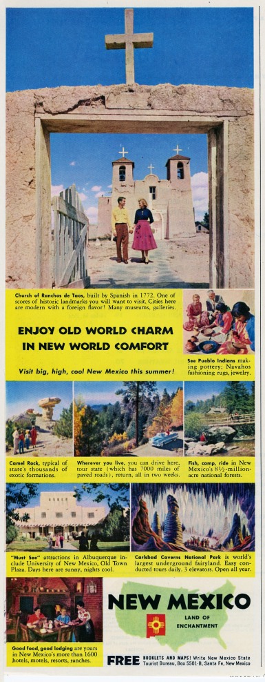
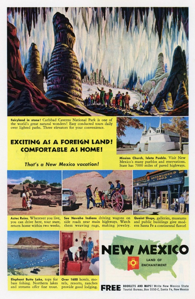
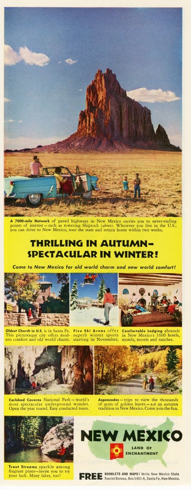
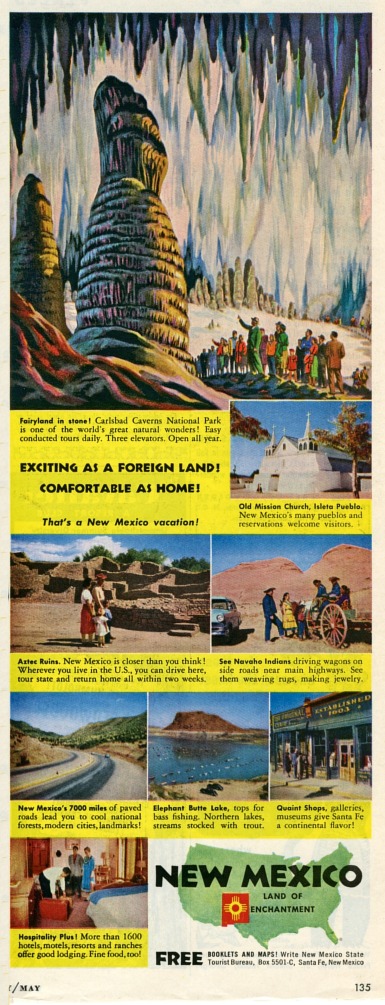
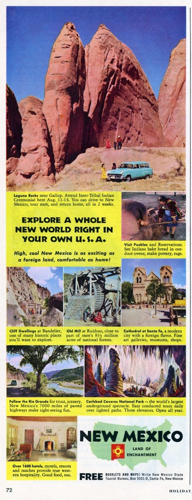
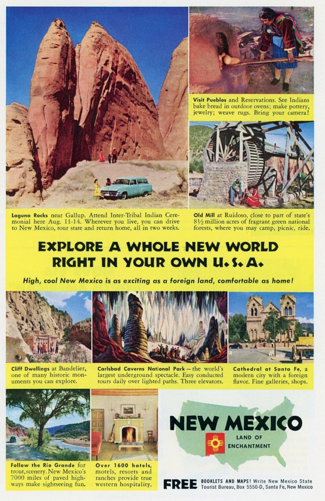
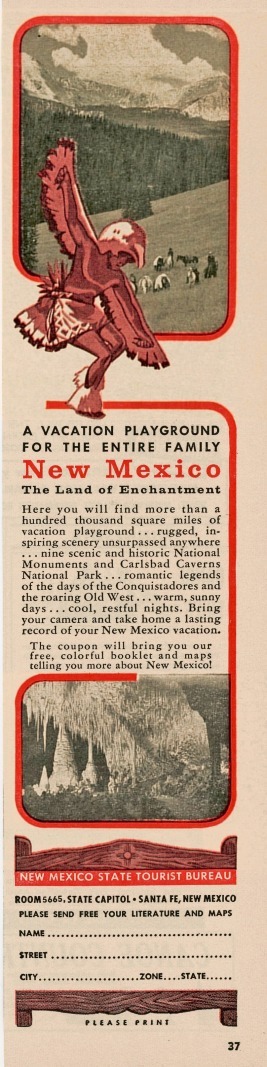
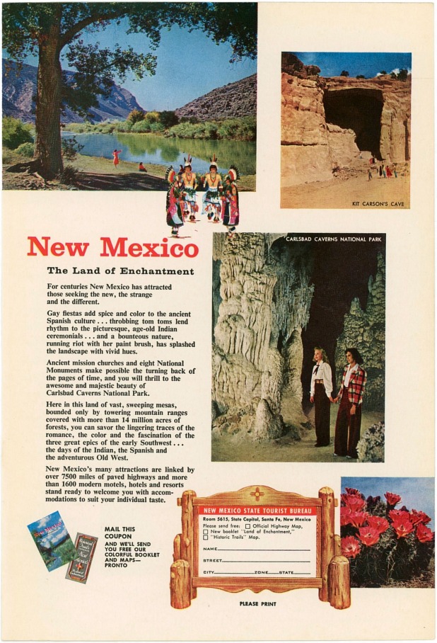
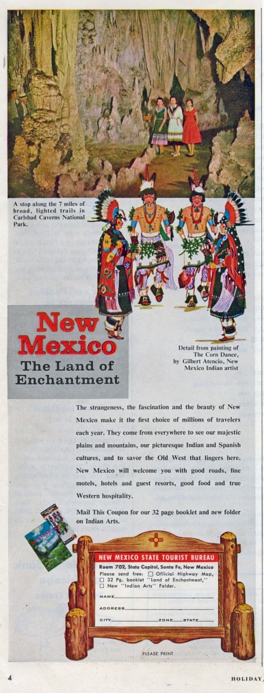
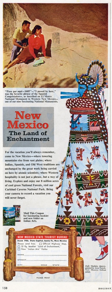
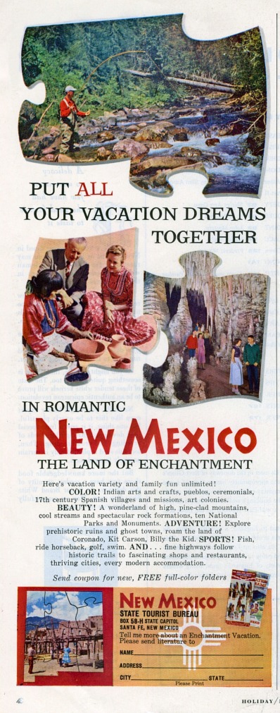
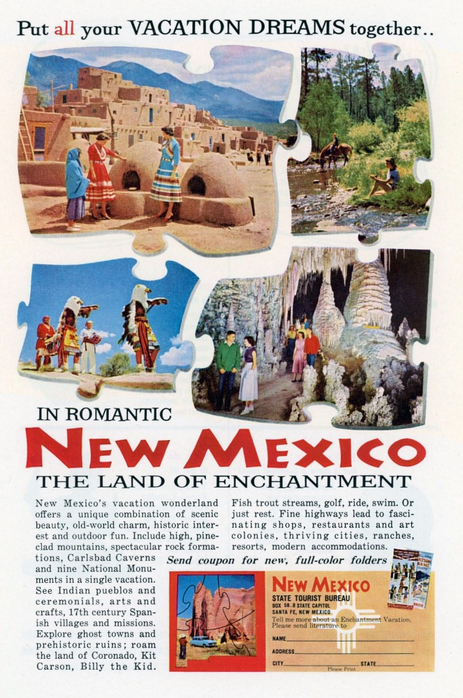
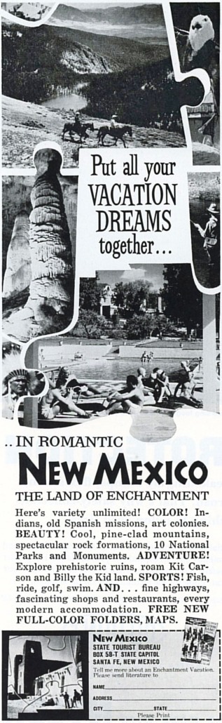
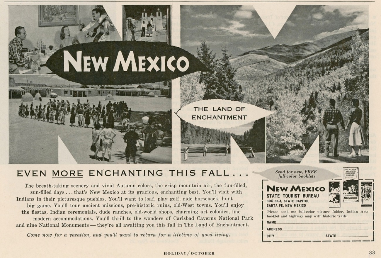
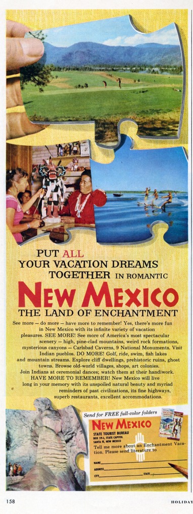
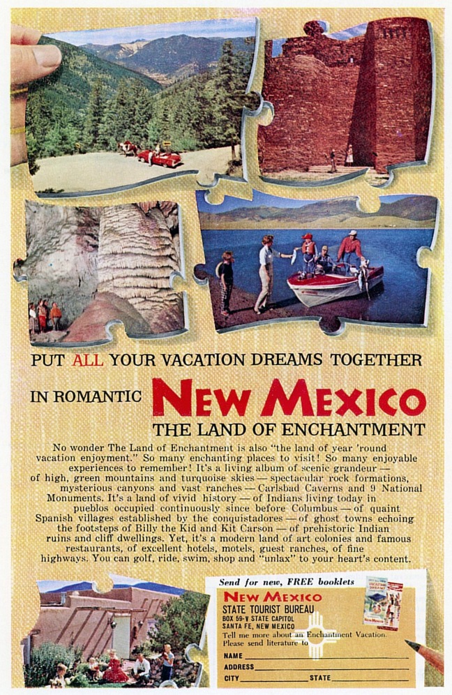
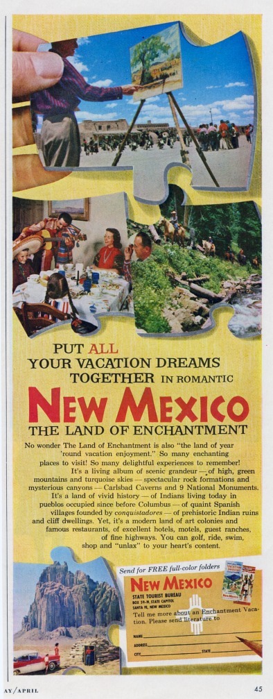
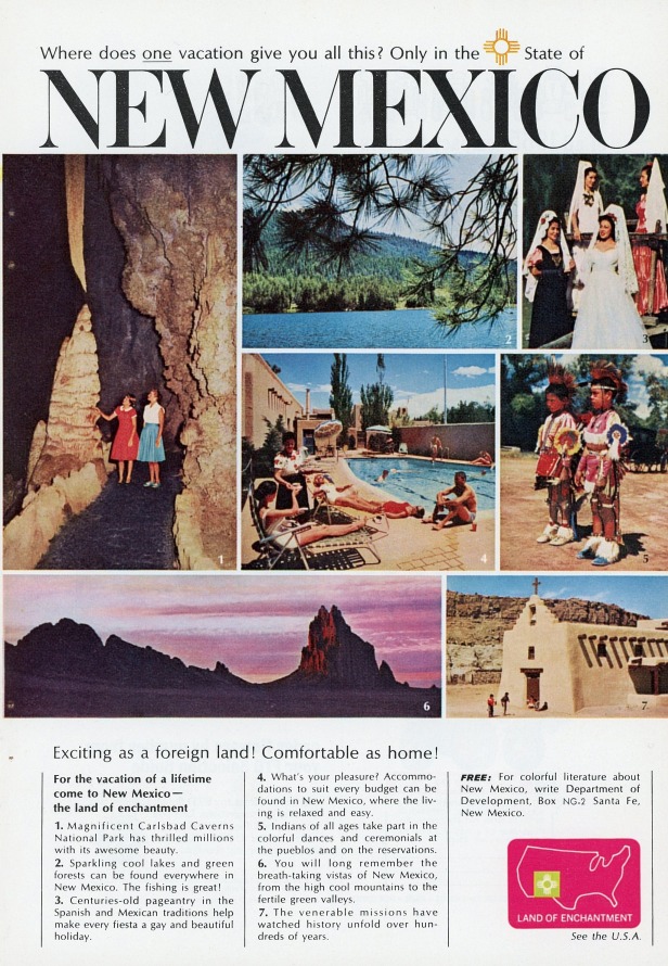
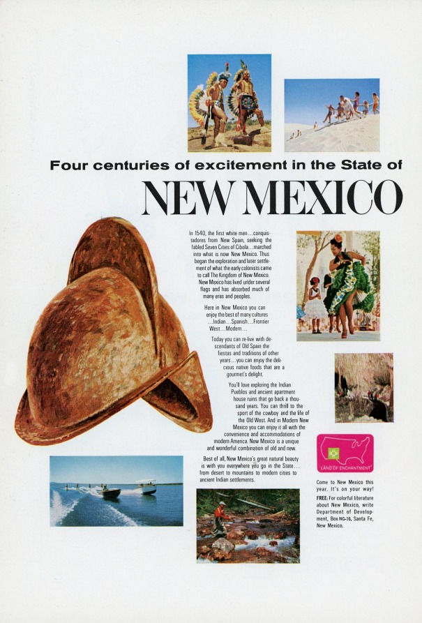
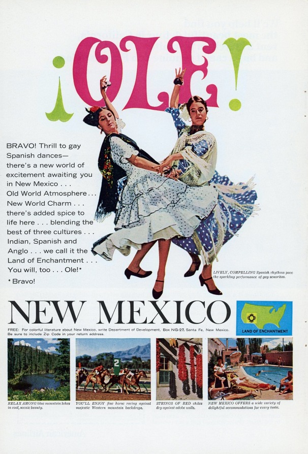
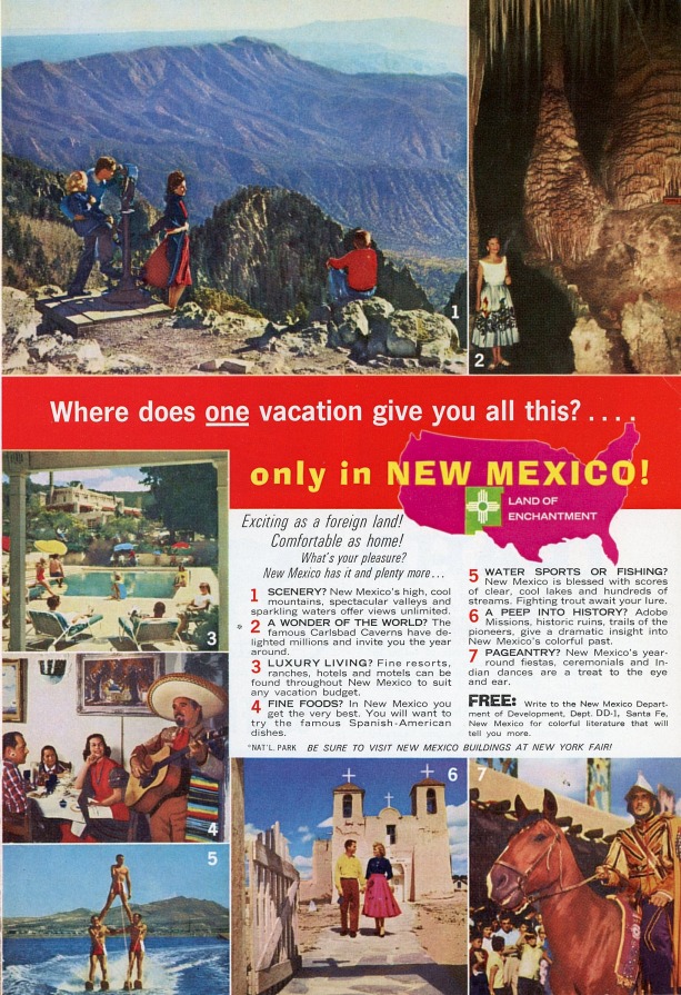
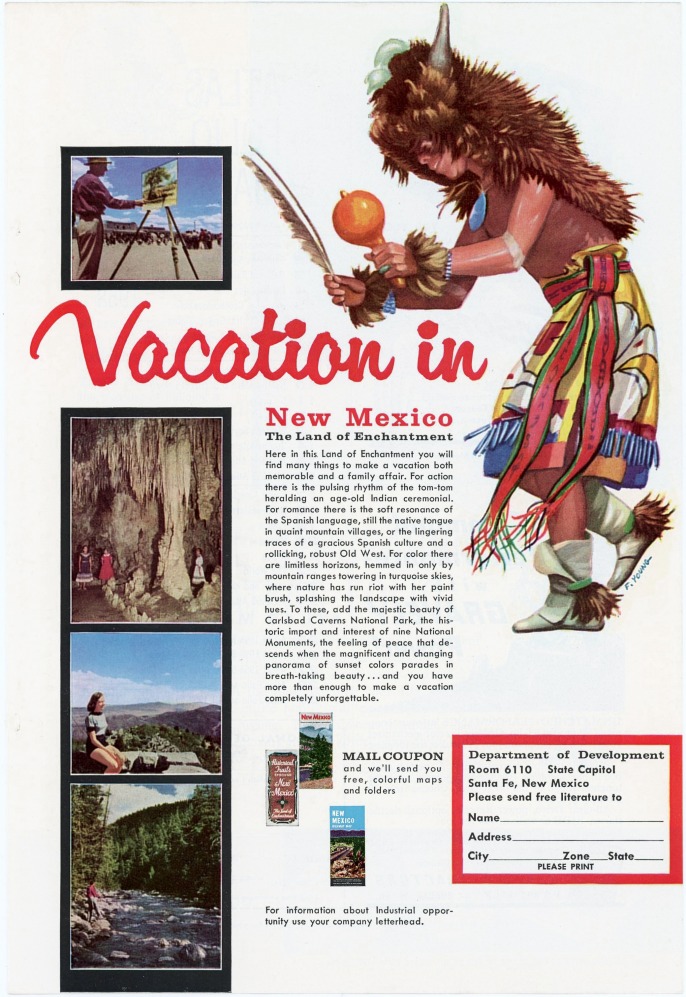
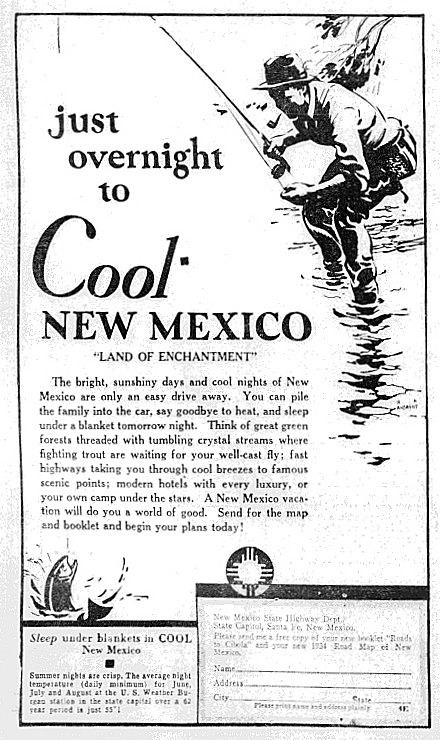
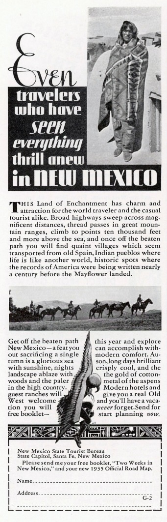
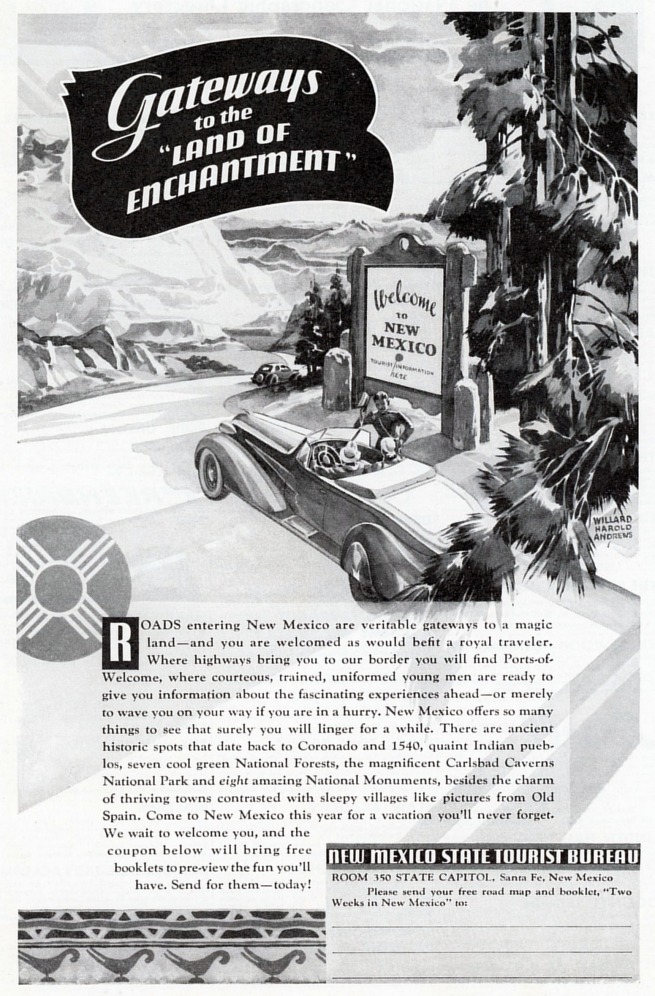
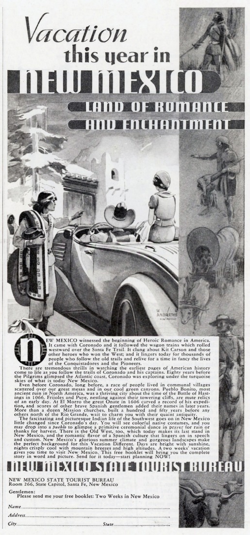
Beginning with its formation in 1935, and continuing until World War II,
the New Mexico State Tourist Bureau published a series of highly
successful and especially colorful pamphlets and folders promoting the
state’s culture and scenicwonders. The success of these publications was
in large part due to the work of New Mexico artist Willard Andrews whose
paintings appeared on many of the covers and interior pages. Most of
those known from this period are illustrated above in the Tourism
Publications section of this page.
The coming of World War II and the concurrent necessity for the
rationing of gasoline, tires and other commodities brought an abrupt
halt to discretionary travel, such that the production of tourism
publications and Official State Road Maps was suspended for the
duration. The reconversion to a peacetime economy had already begun when
the war ended in 1945, and by the following year the production and
distribution of Tourist Bureau publications was again in full swing.
In order to reach the greatest number of prospective tourists the Bureau
simultaneously initiated an advertising campaign in a number of national
magazines, with emphasis in National Geographic and Holiday. (The latter
periodical was a large-format vacation and travel magazine whose pages
measured a huge 11" x 14", and which was published from 1946 to 1977.)
Below you will see a cross section of these ads, which ran from 1936
until the tourist Bureau was superseded by the Department of Development
in about 1960. Because of the great variation in sizes of the
original ads it was found necessary to reproduce them here at a fixed
height. Those ads which are seen here at a width-to-height ratio of about
1.4 are from National Geographic; almost all others—both wide and
narrow—are from Holiday.
|
.jpg)